Marine Weather and Tide Forecast for Lynden, WA
 | Sunrise 8:09 AM Sunset 5:38 PM Moonrise 6:49 AM Moonset 3:52 PM |
Marine Forecasts
NOTE: Zones updated 4/16/2026. Some zones changed. Use Edit if needed.
PZZ133 Northern Inland Waters Including The San Juan Islands- 1227 Am Pst Sun Nov 8 2026
.gale warning in effect until 4 am pst early this morning - .
Today - SW wind 20 to 25 kt with gusts to 35 kt, becoming S 5 to 10 kt. Waves around 3 ft this morning, then around 2 ft or less. A chance of rain this morning, then a slight chance of rain early this afternoon.
Tonight - SE wind 5 to 10 kt. Waves around 2 ft or less.
Mon - E wind 5 to 10 kt, becoming se 15 to 20 kt in the afternoon. Waves around 2 ft or less. Rain in the afternoon.
Mon night - SE wind 15 to 20 kt. Waves around 2 ft or less. Rain.
Tue - SE wind 20 to 25 kt. Waves around 3 ft. Rain.
Tue night - SE wind 20 to 25 kt with gusts up to 40 kt. Waves 3 to 4 ft. Rain.
Wed - SE wind 20 to 25 kt, easing to 15 to 20 kt in the afternoon. Waves 3 to 4 ft in the morning, then around 2 ft or less.
Wed night - SE wind 10 to 15 kt. Waves around 2 ft or less.
Thu - SE wind 10 to 15 kt, easing to 5 to 10 kt in the afternoon. Waves around 2 ft or less. A chance of rain.
Thu night - SE wind 10 to 15 kt, rising to 15 to 20 kt after midnight. Waves around 2 ft or less. Rain likely.
PZZ100 1227 Am Pst Sun Nov 8 2026
Synopsis for the northern and central washington coastal and inland waters - An active period of weather is expected across the area waters this weekend and into next week as a series of frontal systems cross the region. A surface low near 970 millibars will lift northeastward offshore tonight pushing a vigorous frontal system into the area. High pressure will briefly rebuild across the waters Sunday night into early Monday before another deepening surface low moving northward into the gulf of alaska pushes another front across the waters Monday night into Tuesday.
7 Day Forecast for Marine Location Near Lynden, WA

NEW! Add second zone forecast
| Bellingham Click for Map Sun -- 05:23 AM PST 8.09 feet High Tide Sun -- 06:48 AM PST Moonrise Sun -- 07:07 AM PST Sunrise Sun -- 10:03 AM PST 5.50 feet Low Tide Sun -- 03:01 PM PST 8.28 feet High Tide Sun -- 03:52 PM PST Moonset Sun -- 04:38 PM PST Sunset Sun -- 10:29 PM PST -1.02 feet Low Tide Sun -- 11:02 PM PST New Moon Tide / Current data from XTide NOT FOR NAVIGATION |
Bellingham, Bellingham Bay, Washington, Tide feet
| 12 am |
| 1 |
| 1 am |
| 2.5 |
| 2 am |
| 4.3 |
| 3 am |
| 6 |
| 4 am |
| 7.3 |
| 5 am |
| 8 |
| 6 am |
| 8 |
| 7 am |
| 7.3 |
| 8 am |
| 6.5 |
| 9 am |
| 5.8 |
| 10 am |
| 5.5 |
| 11 am |
| 5.8 |
| 12 pm |
| 6.4 |
| 1 pm |
| 7.2 |
| 2 pm |
| 7.9 |
| 3 pm |
| 8.3 |
| 4 pm |
| 8 |
| 5 pm |
| 7.1 |
| 6 pm |
| 5.7 |
| 7 pm |
| 3.7 |
| 8 pm |
| 1.6 |
| 9 pm |
| -0 |
| 10 pm |
| -0.9 |
| 11 pm |
| -0.9 |
Tide / Current for Cherry Point, 1.8 nmi southeast of (depth 8 ft), Rosario Strait, Washington Current
| Cherry Point Click for Map Flood direction 346 true Ebb direction 156 true Sun -- 02:25 AM PST 0.80 knots Max Flood Sun -- 05:40 AM PST -0.00 knots Slack Sun -- 06:50 AM PST Moonrise Sun -- 07:09 AM PST Sunrise Sun -- 09:02 AM PST -0.47 knots Max Ebb Sun -- 01:15 PM PST 0.00 knots Slack Sun -- 02:48 PM PST 0.24 knots Max Flood Sun -- 03:53 PM PST Moonset Sun -- 04:24 PM PST -0.00 knots Slack Sun -- 04:39 PM PST Sunset Sun -- 08:14 PM PST -0.74 knots Max Ebb Sun -- 11:02 PM PST New Moon Sun -- 11:55 PM PST 0.00 knots Slack Tide / Current data from XTide NOT FOR NAVIGATION |
Cherry Point, 1.8 nmi southeast of (depth 8 ft), Rosario Strait, Washington Current, knots
| 12 am |
| 0.2 |
| 1 am |
| 0.5 |
| 2 am |
| 0.8 |
| 3 am |
| 0.8 |
| 4 am |
| 0.5 |
| 5 am |
| 0.2 |
| 6 am |
| -0.1 |
| 7 am |
| -0.3 |
| 8 am |
| -0.4 |
| 9 am |
| -0.5 |
| 10 am |
| -0.4 |
| 11 am |
| -0.4 |
| 12 pm |
| -0.3 |
| 1 pm |
| -0.1 |
| 2 pm |
| 0.2 |
| 3 pm |
| 0.2 |
| 4 pm |
| 0.1 |
| 5 pm |
| -0.2 |
| 6 pm |
| -0.4 |
| 7 pm |
| -0.6 |
| 8 pm |
| -0.7 |
| 9 pm |
| -0.7 |
| 10 pm |
| -0.6 |
| 11 pm |
| -0.3 |
FXUS66 KSEW 080553 AFDSEW
Area Forecast Discussion National Weather Service Seattle WA 953 PM PST Sat Nov 7 2026
UPDATE
A stormy night has been felt across portions of western WA so far. A cold front associated with a deep sub 970 mb low well offshore is currently pushing across the area with widespread rainfall and gusty winds. So far, the strongest winds have been at Hoquiam Bowerman where gusts upwards of 69 MPH was observed just before 7:00 PM local time. Gusty winds will continue to spread inland as Wind Advisories remain posted throughout much of the interior lowlands through late tonight.
Post-frontal - a cold airmass aloft is leading to steep low- level lapse rates (> 7 C/km along the coast and open waters) and convection as lightning has been analyzed over the offshore waters. Hi-res model guidance has this activity tracking inland as steadier rainfall transitions to showers and the potential for thunderstorms throughout the overnight hours. The SPC has W WA highlighted under a general to marginal risk of severe weather. Big waves will also continue build in the wake of the aforementioned front as a High Surf Warning remains in place for the coast. The previous discussion remains below along with an updated aviation section.
SYNOPSIS
A frontal system will cross over the area this evening into Sunday morning, bringing widespread lowland rain, gusty winds, high elevation mountain snow, and high surf conditions. A brief break late Sunday before another wet and windy system moves into the area late Monday into Tuesday. Active weather continues through the end of the week with multiple systems passing into the area.
SHORT TERM /TONIGHT THROUGH MONDAY NIGHT/
Brief dry conditions this afternoon across much of the area will be short lived, as a potent cold front crosses over western Washington this evening through Sunday morning.
We'll start to see an increase in lowland rain spreading along the coast this evening with widespread rainfall through in the interior tonight. Additionally, there is some instability with the aforementioned front, with a 20-30% chance of isolated thunderstorms, primarily along the coast. Could see a lightning strike or two in the interior, but less of chance of thunderstorms (10-20%). As rain spreads throughout the region southerly winds will increase over much of the area. Latest REFS guidance shows a 50-70% chance of wind gusts over 55 mph along for areas along the coast. Therefore, a High Wind Warning continues to remain in effect for areas along the coast.
Elsewhere, A Wind Advisory is out for interior areas, seeing gusts anywhere from 45 to 50 mph at times. Due to continued foliage on the trees for many locations, localized power outages can be possible. Furthermore, clogged storm drains may occur when the period of gusty winds overlaps with steadier rain this evening. Give yourself extra time if traveling this evening. The wind will peak during the overnight hours into early Sunday morning, before steadily decreasing late Sunday afternoon.
Seas will rise rapidly tonight into Sunday, building to 22 to 28 feet along the beaches tonight. A High Surf Warning remains in effect tonight for these areas. Those participating in razor clam digs should exercise caution, as large waves and strong winds will make for dangerous conditions for the clam dig.
Widespread steadier rain will transition into a more post- frontal shower environment through Sunday afternoon, with most of the shower activity focused on the North Cascades and Olympics. The primary concern shifts to high surf conditions along the coast on Sunday. Snow levels generally around 7000 to 7500 feet will fall to 4500 feet, for some accumulations in the higher terrain of the mountains. Shower activity will decrease over the interior throughout the day. High temps in the mid 50s.
A break in the weather Sunday evening before another system rolls right on in on Monday for another round of widespread rain and locally breezy conditions. Most of the QPF, once again is focused on the Olympics.
LONG TERM /TUESDAY THROUGH SATURDAY/
Latest ensemble guidance a bit shaky on timings and strength of upcoming systems. A steady plume of moisture looks to become more focused along Vancouver Island and parts of western Washington on Tuesday into Wednesday for more widespread rainfall, warmer temps, and breezy conditions. Most of the precip is aimed along the Olympics and North Cascades, with most of the interior seeing showers at times. Active weather continues with additional systems at the end of the week for more rainfall and breezy conditions. It seems like we have entered the active weather season this November!
Mazurkiewicz
AVIATION
The narrow cold frontal rain band passing brought heavy rain and low visibility to the Puget Sound terminal. Strong southerly surface winds with gusts 35 to 45 knots are peaking in the interior at this hour. Winds will peak during the overnight period and gradually ease through Sunday morning. Showers will persist through Sunday morning, tapering later in the day. A few isolated thunderstorms will be possible in any heavier bands of showers, but confidence in occurrence remains too low for inclusion in any TAF at this time.
KSEA...Wind gusts to 30 to 35 kt will linger tonight before easing early Sunday morning. Otherwise, expect mostly VFR ceilings with lingering showers through the overnight period now that the main rain band is through. A low (10%) chance of a thunderstorm overnight, but likelihood is too low for TAF inclusion.
MARINE
An active weather pattern will continue over the next several days as a series of frontal systems move across the area waters.
A vigorous frontal system associated with a deepening surface low offshore British Columbia will swing across the waters tonight into early Sunday. This system will produce a period of storm force wind gusts over the coastal waters and gales across the interior waters tonight into early Sunday. Seas will build to 22 to 28 feet late tonight into Sunday before gradually subsiding again Sunday night into Monday. Isolated thunderstorms will be possible in the wake of the system tonight into Sunday morning and may bring brief heavy downpours, lightning, gusty winds, and reduced visibilities to the area waters.
Weak high pressure will briefly build over the waters on Monday before another deepening surface low moving northward into the Gulf of Alaska pushes another front across the area waters Monday night into Tuesday. Seas will build back towards 16-18 ft on Tuesday and persist in this range into Wednesday.
Additional frontal systems will move through the waters mid to late week, likely bringing more rounds of widespread headlines to the area waters.
HYDROLOGY
River flooding is not expected through the next seven days.
Multiple weather systems moving through the area in the next week. While current precipitation forecasts are not expected to cause flooding, this will saturate soils and raise base flows that could bring a concern with storm systems by late next week.
SEW WATCHES/WARNINGS/ADVISORIES
WA...Wind Advisory until 4 AM PST Sunday for City of Seattle- Downtown Everett / Marysville Area-Eastern Kitsap County- Eastside-Foothills of the Western and Southern Olympic Peninsula-Island County-Lake Crescent Area Including US 101-Lower Chehalis River Valley-Lowlands of Pierce and Southern King Counties-Lowlands of Western Skagit and Northwestern Snohomish Counties-Lowlands of Western Whatcom County-Middle Chehalis River Valley-Northern Hood Canal-Olympia and Southern Puget Sound-Port Townsend Area- San Juan County-Shoreline / Lynnwood / South Everett Area- Southern Hood Canal-Western Strait of Juan de Fuca- Willapa and Black Hills.
High Wind Warning until 4 AM PST Sunday for Grays Harbor County Coast-Northern Washington Coast.
High Surf Warning until 10 PM PST Sunday for Grays Harbor County Coast-Northern Washington Coast.
PZ...Small Craft Advisory until 10 PM PST Sunday for Grays Harbor Bar.
Gale Warning until 10 AM PST Sunday for Central U.S. Waters Strait Of Juan De Fuca-East Entrance U.S. Waters Strait Of Juan De Fuca-West Entrance U.S. Waters Strait Of Juan De Fuca.
Gale Warning until 4 AM PST Sunday for Admiralty Inlet- Northern Inland Waters Including The San Juan Islands.
Gale Warning until 7 AM PST Sunday for Puget Sound and Hood Canal.
Storm Warning until 10 AM PST Sunday for Coastal Waters From Cape Flattery To James Island 10 To 60 Nm-Coastal Waters From Cape Flattery To James Island Out 10 Nm-Coastal Waters From James Island To Point Grenville 10 To 60 Nm- Coastal Waters From James Island To Point Grenville Out 10 Nm-Coastal Waters From Point Grenville To Cape Shoalwater 10 To 60 Nm-Coastal Waters From Point Grenville To Cape Shoalwater Out 10 Nm.
Area Forecast Discussion National Weather Service Seattle WA 953 PM PST Sat Nov 7 2026
UPDATE
A stormy night has been felt across portions of western WA so far. A cold front associated with a deep sub 970 mb low well offshore is currently pushing across the area with widespread rainfall and gusty winds. So far, the strongest winds have been at Hoquiam Bowerman where gusts upwards of 69 MPH was observed just before 7:00 PM local time. Gusty winds will continue to spread inland as Wind Advisories remain posted throughout much of the interior lowlands through late tonight.
Post-frontal - a cold airmass aloft is leading to steep low- level lapse rates (> 7 C/km along the coast and open waters) and convection as lightning has been analyzed over the offshore waters. Hi-res model guidance has this activity tracking inland as steadier rainfall transitions to showers and the potential for thunderstorms throughout the overnight hours. The SPC has W WA highlighted under a general to marginal risk of severe weather. Big waves will also continue build in the wake of the aforementioned front as a High Surf Warning remains in place for the coast. The previous discussion remains below along with an updated aviation section.
SYNOPSIS
A frontal system will cross over the area this evening into Sunday morning, bringing widespread lowland rain, gusty winds, high elevation mountain snow, and high surf conditions. A brief break late Sunday before another wet and windy system moves into the area late Monday into Tuesday. Active weather continues through the end of the week with multiple systems passing into the area.
SHORT TERM /TONIGHT THROUGH MONDAY NIGHT/
Brief dry conditions this afternoon across much of the area will be short lived, as a potent cold front crosses over western Washington this evening through Sunday morning.
We'll start to see an increase in lowland rain spreading along the coast this evening with widespread rainfall through in the interior tonight. Additionally, there is some instability with the aforementioned front, with a 20-30% chance of isolated thunderstorms, primarily along the coast. Could see a lightning strike or two in the interior, but less of chance of thunderstorms (10-20%). As rain spreads throughout the region southerly winds will increase over much of the area. Latest REFS guidance shows a 50-70% chance of wind gusts over 55 mph along for areas along the coast. Therefore, a High Wind Warning continues to remain in effect for areas along the coast.
Elsewhere, A Wind Advisory is out for interior areas, seeing gusts anywhere from 45 to 50 mph at times. Due to continued foliage on the trees for many locations, localized power outages can be possible. Furthermore, clogged storm drains may occur when the period of gusty winds overlaps with steadier rain this evening. Give yourself extra time if traveling this evening. The wind will peak during the overnight hours into early Sunday morning, before steadily decreasing late Sunday afternoon.
Seas will rise rapidly tonight into Sunday, building to 22 to 28 feet along the beaches tonight. A High Surf Warning remains in effect tonight for these areas. Those participating in razor clam digs should exercise caution, as large waves and strong winds will make for dangerous conditions for the clam dig.
Widespread steadier rain will transition into a more post- frontal shower environment through Sunday afternoon, with most of the shower activity focused on the North Cascades and Olympics. The primary concern shifts to high surf conditions along the coast on Sunday. Snow levels generally around 7000 to 7500 feet will fall to 4500 feet, for some accumulations in the higher terrain of the mountains. Shower activity will decrease over the interior throughout the day. High temps in the mid 50s.
A break in the weather Sunday evening before another system rolls right on in on Monday for another round of widespread rain and locally breezy conditions. Most of the QPF, once again is focused on the Olympics.
LONG TERM /TUESDAY THROUGH SATURDAY/
Latest ensemble guidance a bit shaky on timings and strength of upcoming systems. A steady plume of moisture looks to become more focused along Vancouver Island and parts of western Washington on Tuesday into Wednesday for more widespread rainfall, warmer temps, and breezy conditions. Most of the precip is aimed along the Olympics and North Cascades, with most of the interior seeing showers at times. Active weather continues with additional systems at the end of the week for more rainfall and breezy conditions. It seems like we have entered the active weather season this November!
Mazurkiewicz
AVIATION
The narrow cold frontal rain band passing brought heavy rain and low visibility to the Puget Sound terminal. Strong southerly surface winds with gusts 35 to 45 knots are peaking in the interior at this hour. Winds will peak during the overnight period and gradually ease through Sunday morning. Showers will persist through Sunday morning, tapering later in the day. A few isolated thunderstorms will be possible in any heavier bands of showers, but confidence in occurrence remains too low for inclusion in any TAF at this time.
KSEA...Wind gusts to 30 to 35 kt will linger tonight before easing early Sunday morning. Otherwise, expect mostly VFR ceilings with lingering showers through the overnight period now that the main rain band is through. A low (10%) chance of a thunderstorm overnight, but likelihood is too low for TAF inclusion.
MARINE
An active weather pattern will continue over the next several days as a series of frontal systems move across the area waters.
A vigorous frontal system associated with a deepening surface low offshore British Columbia will swing across the waters tonight into early Sunday. This system will produce a period of storm force wind gusts over the coastal waters and gales across the interior waters tonight into early Sunday. Seas will build to 22 to 28 feet late tonight into Sunday before gradually subsiding again Sunday night into Monday. Isolated thunderstorms will be possible in the wake of the system tonight into Sunday morning and may bring brief heavy downpours, lightning, gusty winds, and reduced visibilities to the area waters.
Weak high pressure will briefly build over the waters on Monday before another deepening surface low moving northward into the Gulf of Alaska pushes another front across the area waters Monday night into Tuesday. Seas will build back towards 16-18 ft on Tuesday and persist in this range into Wednesday.
Additional frontal systems will move through the waters mid to late week, likely bringing more rounds of widespread headlines to the area waters.
HYDROLOGY
River flooding is not expected through the next seven days.
Multiple weather systems moving through the area in the next week. While current precipitation forecasts are not expected to cause flooding, this will saturate soils and raise base flows that could bring a concern with storm systems by late next week.
SEW WATCHES/WARNINGS/ADVISORIES
WA...Wind Advisory until 4 AM PST Sunday for City of Seattle- Downtown Everett / Marysville Area-Eastern Kitsap County- Eastside-Foothills of the Western and Southern Olympic Peninsula-Island County-Lake Crescent Area Including US 101-Lower Chehalis River Valley-Lowlands of Pierce and Southern King Counties-Lowlands of Western Skagit and Northwestern Snohomish Counties-Lowlands of Western Whatcom County-Middle Chehalis River Valley-Northern Hood Canal-Olympia and Southern Puget Sound-Port Townsend Area- San Juan County-Shoreline / Lynnwood / South Everett Area- Southern Hood Canal-Western Strait of Juan de Fuca- Willapa and Black Hills.
High Wind Warning until 4 AM PST Sunday for Grays Harbor County Coast-Northern Washington Coast.
High Surf Warning until 10 PM PST Sunday for Grays Harbor County Coast-Northern Washington Coast.
PZ...Small Craft Advisory until 10 PM PST Sunday for Grays Harbor Bar.
Gale Warning until 10 AM PST Sunday for Central U.S. Waters Strait Of Juan De Fuca-East Entrance U.S. Waters Strait Of Juan De Fuca-West Entrance U.S. Waters Strait Of Juan De Fuca.
Gale Warning until 4 AM PST Sunday for Admiralty Inlet- Northern Inland Waters Including The San Juan Islands.
Gale Warning until 7 AM PST Sunday for Puget Sound and Hood Canal.
Storm Warning until 10 AM PST Sunday for Coastal Waters From Cape Flattery To James Island 10 To 60 Nm-Coastal Waters From Cape Flattery To James Island Out 10 Nm-Coastal Waters From James Island To Point Grenville 10 To 60 Nm- Coastal Waters From James Island To Point Grenville Out 10 Nm-Coastal Waters From Point Grenville To Cape Shoalwater 10 To 60 Nm-Coastal Waters From Point Grenville To Cape Shoalwater Out 10 Nm.
| Stations | Dist | Age | Wind | Air | Water | Waves | inHg | DewPt |
| 46118 | 16 mi | 91 min | SW 18G | |||||
| CHYW1 - 9449424 - Cherry Point, WA | 17 mi | 51 min | 29.73 | |||||
| CPMW1 | 17 mi | 51 min | S 22G | 54°F | ||||
| CPNW1 | 17 mi | 51 min | SSE 24G | 54°F | ||||
| PBFW1 - Padilla Bay Reserve, WA | 33 mi | 51 min | S 17 | 55°F | 29.77 | 50°F | ||
| FRDW1 - 9449880 - Friday Harbor, WA | 40 mi | 45 min | SE 6G | 53°F | 29.77 | |||
| SISW1 - Smith Island, WA | 47 mi | 61 min | SSE 22G | 55°F | 29.75 | 50°F |
Wind History for Cherry Point South Dock, WA
toggle option: (graph/table)
Link to 5 hour of 5 minute data for KBLI
Terminal Aerodrome Forecast (TAF) for KBLI
Wind History Graph: BLI
(wind in knots)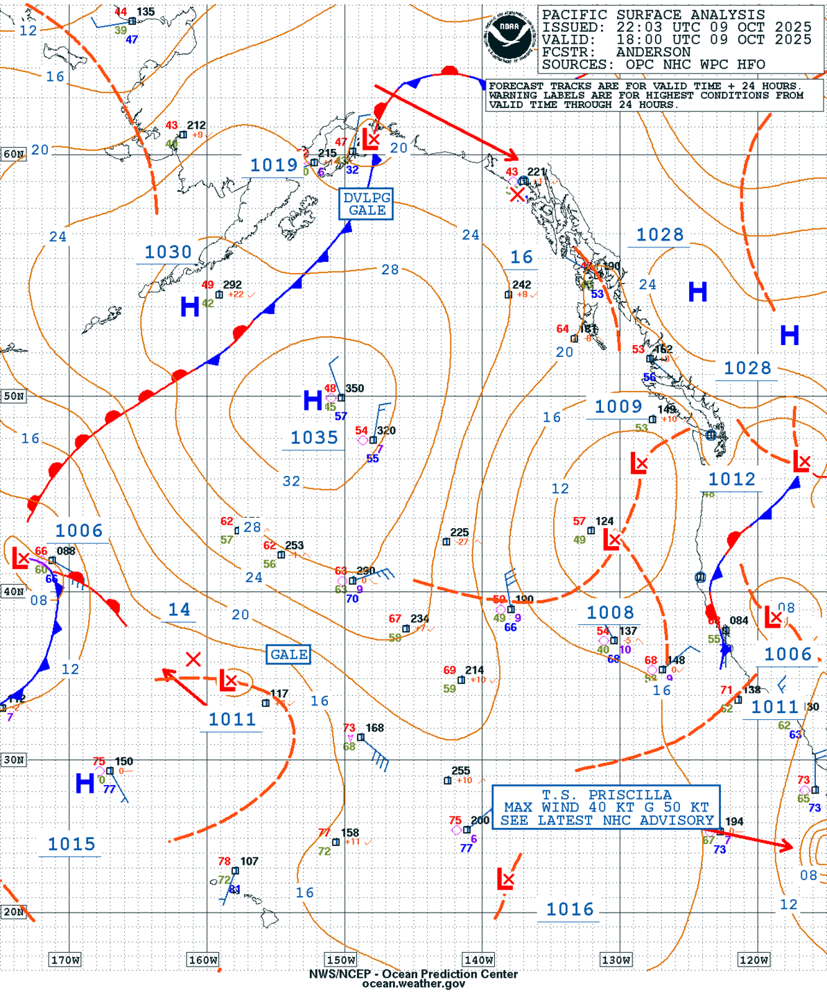
GEOS Local Image of Pacific Northwest
Edit Hide

Seattle/Tacoma, WA,

NOTICE: Some pages have affiliate links to Amazon. As an Amazon Associate, I earn from qualifying purchases. Please read website Cookie, Privacy, and Disclamers by clicking HERE. To contact me click HERE. For my YouTube page click HERE
X