Navigation
Printing your own NOAA Charts
By Allen Edwards
Update
The RNC charts will be a thing of the past on January of 2025. At least one of the links in this article was not working as of 4/6/2024 when I updated this article. The rest worked and I assume you can still print charts. Please let me know if you have trouble so I can update again. Thanks, AllenIntroduction
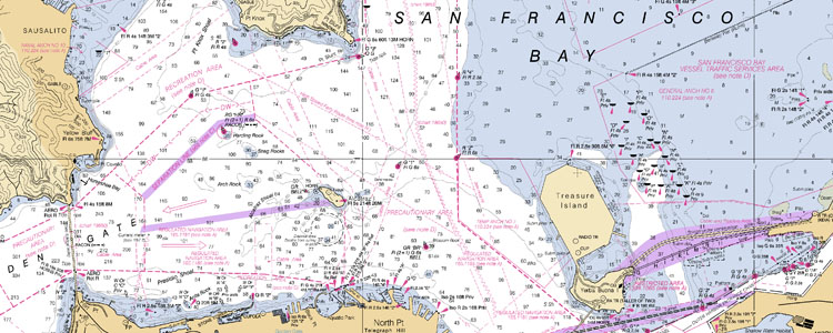
Wouldn't it be great if you could print your own NOAA navigational charts, just the size you want, up to date, and do it for free with free software? I did it and here is how I did it.My First Chart
Getting the Charts
NOAA charts are available for free in two formats: Raster Navigational Charts (RNC) and Electronic Navigational Charts (ENC). The RNC versions which are the same as the paper charts we are all familiar with and the ones we want.- Go to the NOAA online ENC chart viewer (.
- Follow the link for your area. I selected "Pacific Coast."
- Find the chart you are in. I liked 18649. Click on the chart to view it. Make note of the chart numbers you want.
- Go to the Interactive Catalog and select the region you want. I clicked on California. On the right side of the page, click on "Download RNC's
- On the bottom of the user agreement, click on "OK" (read it first).
- That should save a zip file on your computer. Unzip it to a directory of you picking. I used F:/charts.
Conversion Tools
- BSB2PNG -- The program that converts the files is called libbsb. Download it from Sourceforge by clicking on Download. Unzip them into a directory. I used F:/libbsb
- BSBREADER -- A newer easier to use program is called bsbreader. Download it from Sourceforge by clicking this Download Install it.
Running bsb2png
- Open a command prompt. Click "Start", "Run", and type "cmd" then hit enter.
- Navigate to the directory that has the image you want. I typed "F:" then "CD /charts/bsb_root/18649" Use the number you remembered from before in place of 18649.
- Run bsb2png.exe from this directory by typing (in my csae) "/libbsb/lib2png.exe 18649_1.KAP 18649.png" again change 18649 to the number you remember. You might want to type "dir" to make sure of the file name. The main map has the _1. The other maps are the little inserts that go into the blank spaces on the main map. You may or may not want those. It is nice to have the detail maps separate as that way you can put them some other place if you want.
Running bsbreader
- Run bsbreader. I had to open windows exployer and navigate to "c:/Program Files/ BSB Reader" and click on BSBReader. Later the program was listed in "All Programs". Maybe I missed it the first time.
- Select the source and destination directories and PNG as the format.
- Click "GO"
Print your Chart
- Open Image in Paint, Photoshop, or any other image program. Crop it, resize it, print it. That's it.
- Note: If you are pasting together two or more charts to make a chart that covers the area where you sail, make note of the map scale. If you resize them to the same scale, they fit perfectly. For example, with a map that lists the scale as 1:40,000 and another with 1:20,000, if you resize the larger one to 50% it will line up with the other one when you go to stitch them together.
- Once the maps are the same scale, I lined them up by aligning something that has a precise position on both maps, like a buoy. The sketches of the shoreline and the shipping lanes etc were not the same on my two maps but when I lined up the mark, everything was very close.
- I used Photoshop and combined the images by setting the layer property to "Darken"
NOTICE: Some pages have affiliate links to Amazon. As an Amazon Associate, I earn from qualifying purchases. Please read website Cookie, Privacy, and Disclamers by clicking HERE. To contact me click HERE. For my YouTube page click HERE