Miscellaneous
Compass Calibration
Understanding and the ways and hows of calibrating a marine compass
By Allen Edwards
Overview
Everyone understands that a marine compass needs to be calibrated. I am not an expert on compass calibration but got interested in the question when a club member asked me if I had an article on the subject on this web site. It is easy enough to find articles on how to calibrate a marine compass but I found them lacking in two areas. First, they did not explain what was really going on such that I could understand why things were being done. Second, they all recommended you don't actually do the calibration yourself but rather hire an expert. Of course, because I only was presented with a how and a recommendation not to do it, I did not have the knowledge to judge if the procedure was going to be error prone if I did it without some of the fancy tools the professionals have. I kept thinking about it and doing a few experiments until I felt I understood what the goal of all these measurements was and how accurate they needed to be. Of course, I would be a fool if I didn't give the same advice, have an expert do the job for you. But after reading this you might at least understand what is going on and be able to judge for yourself if you think you know enough to calibrate your own compass.What is a compass
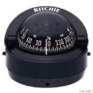
An ideal compass is a magnetized rotating disk sitting on a frictionless pivot that always points to magnetic north. A marine compass often is a disk with degrees printed on it. There is then a pointer line on the case that is fixed to the boat such that when the boat is pointed to magnetic north, the pointer is lined up with the disk's north reading. Then as the boat rotates away from north, it is a simple matter to read the heading of the boat off the disk on the compass.Magnetic vs True North
Converting from Magnetic to True and Back
Almost everything you read tells you that to correct from magnetic to true you add or subtract the variation. The question I want answered is do I add or subtract the variation and what they are answering is "yes".There are tricks and acronyms that help you figure out if you should add or subtract. The problem is that going one way (true to magnetic) you add (or subtract) and going the other way you do the opposite. It gets very confusing and these tricks are not something I am likely to remember when push comes to shove. The question becomes how can you just figure it out?
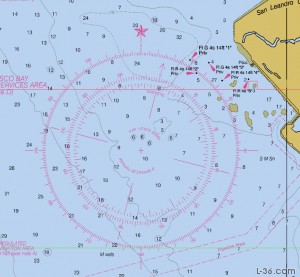
You must know your locations variation. Remember, it's printed in the center of the compass rose on every nautical chart. If you don't know that, you can't solve the problem. The nice thing is that if you know that, you know all you need to know. The variation where I am, in San Francisco, is 14 degrees East. Variation everywhere on the west coast is east and on the east coast it is west. It is like the magnetic pole is somewhere in the middle of the country and when you are on the coast, the compass is going to point a little too much toward Iowa. (A variation of 0 degrees runs through Iowa)
I know my variation is 14 degrees East and that my compass is going to point that amount toward Iowa, East which is a clockwise direction.
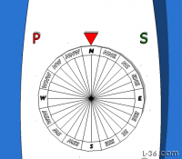
If I am sailing due north magnetic, I know my compass is pointing 14 degrees toward the east (my variation is 14E) and because degrees are defined as increasing in a clockwise direction and east is clockwise from north, I must be pointing at 14 degrees true. Thus if I want to know my true heading I need to add 14 degrees to my magnetic heading. Conversely, if I have a true heading, I need to subtract 14 degrees to get the reading I should be looking for on my compass. Have a look at the compass rose here and see how this works.
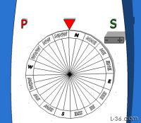
If the variation is west, this process will still get you the correct answer, just think of the compass pointing to the west of north but instead of thinking of 356 degrees, think of it as -4 degrees. In other words, if your variation is 4 degrees west,when you are heading magnetic north your true heading is 4 degrees counter clockwise and your heading is 356 degrees true or 4 degrees less than north, which is 360.
The point is, just remembering that the variation tells you where your compass will point relative to true north is all you need. In the US, just knowing that the compass will tend to point a little too much toward the center of the country (remember Iowa) by the number of degrees of variation should be enough to figure out if you add or subtract.
Frame of Reference
You might notice I talk about the compass always pointing to north and the boat rotating around the fixed compass. This is, imho, an important frame of reference to take. The alternative is to think about the boat frame of reference where the compass moves as the boat turns. But a lot of what is going on becomes clear if you think in the reference of the compass and the compass never changes where it is pointed. It is the boat that changes direction around it. At least that is the case and if everything was ideal, calibrating your compass would be a simple matter of either aligning the pointer correctly, or knowing the fixed number of degrees you were off because perhaps the bulkhead you have the compass mounted on is not truly athwartship.Check mechanical properties
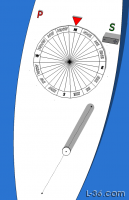
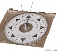
Before I talk about the areas of calibration on the compass, let me just point out one of the assumptions. That is that the compass disk is mounted on a frictionless pivot. If the pivot has friction, the compass will not point to the same point as the boat moves counter clockwise compared to where it is pointing when the boat moves clockwise. The friction of the pivot will pull the compass disk a little and cause the reading to be wrong. You need to make sure this is not the case as no calibration can take that error out. Ideally you would remove the compass from the boat and make a test on a work bench rotating the compass in both directions and seeing if it keeps pointing to the same north indication regardless of how the case is moved. It is obviously OK to have some fluid friction that causes the compass to move as the case is rotated as long as the disk returns to the same heading eventually.Adjusting the N-S and E-W compensation
 |
 |
 |
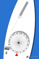 |
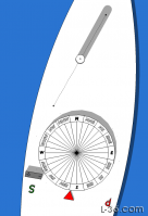 It is important to make sure you are not introducing any magnatic material close to the compass when you do this adjustment. Your screwdriver should not be metal. No watches or coins or cell phones. How about your belt buckle. If the airport would make you put it in a tray, don't get it near the compass when you are doing the adjustment. |
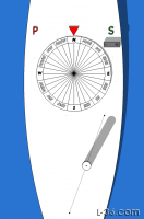 Note that if you make large adjustments, you may have to repeat the procedure to get the best accuracy. Basically, repeat the procedure until no adjustment is required. |
Calibrate one point
If you can rotate your compass, adjust the pointer, or shim a bulkhead now is the time to make sure that the compass is calibrated at at least one known direction. If you have something like a breakwater that has a known alignment, or a landmark several miles away you can use that. A rough guideline is that if you know where you are within 100 feet then something a mile away will be knows to about a degree. If you can find a mountain 10 miles away, that should be fine. The other way is to use the sun.Calibrate using the Sun
Remember that you are reading magnatic directions and the sun directions will be in true directions. You need to know your locations variation and correct. Be sure to go in the right direction. There are a couple of links you need. You need to know what time zone you are in and you can find that HERE. Remember to adjust for Daylight Savings Time. For example, I am in region "U" so 8 hours from GMT. But in summer I am only 7 hours off. So in summer I am GMT-7 while in winter GMT-8.Next you need to know where the sun will be at any given time on your day in question. The US Navy has a nice site that allows you to print out a table to take with you for your calibration. You can find that at http://aa.usno.navy.mil/data/docs/AltAz.php
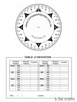
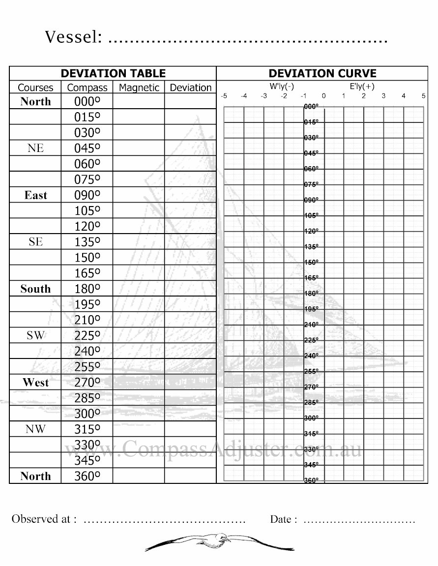
Make a Deviation Table
 |
 |
Navigation
There are even three types of bearings: true, magnetic, and compass bearing. Compass error is divided into two parts, namely magnetic variation and magnetic deviation, the latter originating from magnetic properties of the vessel or aircraft. Variation and deviation are signed quantities. As discussed above, positive (easterly) variation indicates magnetic north being east of geographic north. Deviation is positive if a compass bearing mark points to the right of the related magnetic bearing. If one knows compass bearing and wants to determine true bearing the following calculations apply:- Compass bearing + deviation = magnetic bearing
- Magnetic bearing + variation = true bearing.
- True bearing - variation = Magnetic bearing
- Magnetic bearing - deviation = Compass bearing.
- TC = true course
- V = variation (of the Earth's magnetic field)
- MC = magnetic course (what the course would be in the absence of local declination)
- D = deviation caused by magnetic material (mostly iron and steel) on the vessel
- CC = compass course
Variation
Magnetic variation is the angle from magnetic north to true north (positive in clockwise, easterly direction) and is caused by the different locations of the Geographic North Pole and the Magnetic North Pole plus any local anomalies such as iron deposits. Variation is positive (easterly) if magnetic north (MN) is right (easterly) of geographic north (true north, TN). Variation is negative if magnetic north is left (westerly) of true north. Variation is the same for all compasses in the same location and is usually stated on good quality maps and charts, along with the date it was measured. Variation has to be added to magnetic bearing to obtain true bearing.Deviation
Magnetic deviation is the angle from a given magnetic bearing to the related bearing mark of the compass. Deviation is positive if a compass bearing mark (e.g. compass north) is right of the related magnetic bearing (e.g. magnetic north) and vice versa. For example, if the boat is aligned to magnetic north and the compass' north mark points 3° more east, deviation is +3°. Deviation varies for every compass in the same location and depends on such factors as the magnetic field of the vessel, wristwatches, etc. The value will also vary depending on the orientation of the boat. Magnets and/or iron masses can be used to correct for deviation so that a particular compass will accurately give magnetic bearings. More commonly, however, a correction card will be drawn up listing error for the compass which can then be compensated for arithmetically. Deviation has to be added to compass bearing to obtain magnetic bearing.Declination
Magnetic declination is the angle between compass north (the direction the north end of a compass needle points) and true north (the direction along the earth's surface towards the geographic North Pole). The declination is positive when the magnetic north is east of true north. The term magnetic variation is a synonym, and is more often used in navigation.More
For a detailed and official document see the "HANDBOOK OF MAGNETIC COMPASS ADJUSTMENT"NOTICE: Some pages have affiliate links to Amazon. As an Amazon Associate, I earn from qualifying purchases. Please read website Cookie, Privacy, and Disclamers by clicking HERE. To contact me click HERE. For my YouTube page click HERE