Marine Weather and Tide Forecast for Northampton, MA
 | Sunrise 6:32 AM Sunset 4:35 PM Moonrise 7:01 AM Moonset 4:51 PM |
Marine Forecasts
NOTE: Zones updated 4/16/2026. Some zones changed. Use Edit if needed.
ANZ331 Long Island Sound East Of New Haven Ct/port Jefferson Ny To The Mouth Of The Connecticut River- 157 Am Est Sun Nov 8 2026
.small craft advisory in effect through Monday afternoon - .
Today - W winds 15 to 20 kt, diminishing to 10 to 15 kt late. Gusts up to 30 kt. Seas 2 to 3 ft. Wave detail: W 3 ft at 5 seconds. Slight chance of showers early this morning.
Tonight - W winds 10 to 15 kt, increasing to 15 to 20 kt after midnight. Gusts up to 25 kt. Seas 2 to 3 ft. Wave detail: W 3 ft at 4 seconds.
Mon - W winds 15 to 20 kt with gusts up to 25 kt. Seas 2 to 3 ft. Wave detail: W 3 ft at 4 seconds. Slight chance of showers in the morning.
Mon night - W winds 10 to 15 kt with gusts up to 20 kt. Seas 2 to 3 ft. Wave detail: W 3 ft at 4 seconds.
Tue - W winds 10 to 15 kt with gusts up to 25 kt. Seas around 2 ft. Wave detail: W 2 ft at 4 seconds.
Tue night - W winds around 10 kt. Seas around 2 ft. Wave detail: W 2 ft at 3 seconds.
Wed - W winds 5 to 10 kt. Seas 1 ft or less.
Wed night - N winds 5 to 10 kt. Seas 1 ft or less.
Thu - NE winds 5 to 10 kt. Seas 1 ft or less.
Thu night - NE winds 25 to 30 kt. Seas 2 to 4 ft, occasionally to 5 ft. Rain likely.
ANZ300 157 Am Est Sun Nov 8 2026
Synopsis for the long island and connecticut coastal waters - Low pressure strengthens as it moves northward into the canadian maritimes today. This low remains in southeast canada tonight and eventually weakens Monday. Meanwhile, a series of frontal systems pass through early into midweek. Stronger and larger low pressure develops near the vicinity of the local waters towards late in the week.
7 Day Forecast for Marine Location Near Northampton, MA

NEW! Add second zone forecast
| Hartford Click for Map Sun -- 01:22 AM EST 1.82 feet High Tide Sun -- 05:58 AM EST Moonrise Sun -- 06:31 AM EST Sunrise Sun -- 09:06 AM EST 0.26 feet Low Tide Sun -- 01:41 PM EST 2.44 feet High Tide Sun -- 03:52 PM EST Moonset Sun -- 04:36 PM EST Sunset Sun -- 09:53 PM EST 0.07 feet Low Tide Tide / Current data from XTide NOT FOR NAVIGATION |
Hartford, Connecticut River, Connecticut, Tide feet
| 12 am |
| 1.4 |
| 1 am |
| 1.8 |
| 2 am |
| 1.8 |
| 3 am |
| 1.6 |
| 4 am |
| 1.4 |
| 5 am |
| 1.2 |
| 6 am |
| 1 |
| 7 am |
| 0.7 |
| 8 am |
| 0.4 |
| 9 am |
| 0.3 |
| 10 am |
| 0.5 |
| 11 am |
| 1.1 |
| 12 pm |
| 1.8 |
| 1 pm |
| 2.3 |
| 2 pm |
| 2.4 |
| 3 pm |
| 2.3 |
| 4 pm |
| 2 |
| 5 pm |
| 1.7 |
| 6 pm |
| 1.3 |
| 7 pm |
| 0.9 |
| 8 pm |
| 0.5 |
| 9 pm |
| 0.2 |
| 10 pm |
| 0.1 |
| 11 pm |
| 0.4 |
Tide / Current for Hartford Jetty (depth 9 ft), Connecticut River, Long Island Sound, Connecticut Current
| Hartford Jetty (depth 9 ft) Click for Map Flood direction 290 true Ebb direction 95 true Note: Velocities for this station should be disregarded--use times only. Sun -- 12:16 AM EST 0.00 knots Max Flood Sun -- 02:03 AM EST -0.00 knots Slack Sun -- 05:50 AM EST -0.78 knots Max Ebb Sun -- 05:58 AM EST Moonrise Sun -- 06:31 AM EST Sunrise Sun -- 10:36 AM EST 0.00 knots Slack Sun -- 12:22 PM EST 0.00 knots Max Flood Sun -- 02:09 PM EST -0.00 knots Slack Sun -- 03:52 PM EST Moonset Sun -- 04:36 PM EST Sunset Sun -- 06:11 PM EST -0.95 knots Max Ebb Sun -- 11:18 PM EST 0.00 knots Slack Tide / Current data from XTide NOT FOR NAVIGATION |
Hartford Jetty (depth 9 ft), Connecticut River, Long Island Sound, Connecticut Current, knots
| 12 am |
| 0 |
| 1 am |
| 0 |
| 2 am |
| -0 |
| 3 am |
| -0.3 |
| 4 am |
| -0.6 |
| 5 am |
| -0.7 |
| 6 am |
| -0.8 |
| 7 am |
| -0.7 |
| 8 am |
| -0.6 |
| 9 am |
| -0.4 |
| 10 am |
| -0.2 |
| 11 am |
| 0 |
| 12 pm |
| 0 |
| 1 pm |
| 0 |
| 2 pm |
| -0 |
| 3 pm |
| -0.3 |
| 4 pm |
| -0.6 |
| 5 pm |
| -0.9 |
| 6 pm |
| -0.9 |
| 7 pm |
| -0.9 |
| 8 pm |
| -0.8 |
| 9 pm |
| -0.6 |
| 10 pm |
| -0.4 |
| 11 pm |
| -0.1 |
FXUS61 KBOX 081134 AFDBOX
Area Forecast Discussion National Weather Service Boston/Norton MA 634 AM EST Sun Nov 8 2026
WHAT HAS CHANGED
Extended the time of the Small Craft Advisory to Monday evening.
Otherwise, no significant changes to the forecast.
KEY MESSAGES
- Unsettled weather continues this weekend as slow low pressure slowly moves away into the Gulf of Maine.
- Cloudy through midweek with more seasonable temperatures.
- Unsettled weather may return late this week.
DISCUSSION
KEY MESSAGE 1...Unsettled weather moves offshore this morning as a low pressure slowly moves away into the Gulf of Maine.
Latest surface analysis showed that a low pressure over the Gulf of Maine, heading toward Nova Scotia. Meanwhile, a mid level low over southern New England should move offshore later this morning as well. Scattered showers end early, leaving much of today dry.
The colder air aloft will result in gusty west to northwest winds developing, especially after clouds break up.
Temperatures expected to remain slightly above normal through Monday.
KEY MESSAGE 2...Cloudy through midweek with more seasonable temperatures.
We remain under WNW flow with another upper level trough clearing the region through Monday night, and with it cooler temperatures prevail aloft. 850 mb temperatures look to fall below 0C late Monday night then steadily improve through the day on Tuesday to around 2- 4C. These cooler conditions aloft will remain supportive of a mix of clouds and sunshine. Highs Tuesday look to be generally in the 40s and 50s with lows in the 30s.
These more seasonable temperatures are expected to continue through at least midweek as the WNW to W flow aloft continues.
Breezy conditions at the surface are expected at least for Tuesday as another low looks to pass to our northeast.
KEY MESSAGE 3...Unsettled weather may return late this week.
Towards the second half of next week, guidance has continued to indicate possible development of another low pressure originating from just to the south of the region along/just off the mid- Atlantic coast. This looks to be driven by the approach of an upper level shortwave tracking from the Canadian Prairies southeast into the mid- Atlantic region. With this possible system, we could see the return of more unsettled conditions for the second half of the week. A lot of spread remains this far out from this potential system, especially regarding any potential precipitation associated with it.
Some guidance indicates a decent bit of colder air aloft, notably 850 mb temperatures below 0C, approaching the region. As such, temperatures look to drop off a bit towards the end of the week, with ensembles showing mean temperatures in the lower 40s and upper 50s for afternoon highs. Onshore winds may end up keeping coastal areas slightly warmer, and any precipitation that falls there would lean towards rain. Over the colder interior, we could see some rain to wet snow falling. This event is still towards the day 6 and 7 timeframe of the forecast, so much will likely change between now and then regarding the details of this system.
AVIATION /12Z SUNDAY THROUGH THURSDAY/
Forecaster Confidence Levels...
Low - less than 30 percent.
Moderate - 30 to 60 percent.
High - greater than 60 percent.
Today...High confidence.
Areas of MVFR conditions improve to VFR by early afternoon.
MVFR conditions take longer to clear out across the higher terrain of central and western MA. W winds increase to 10-15 kt with gusts as high as 30 kt by this afternoon.
Tonight...High confidence.
VFR. SW winds generally 5-10 kt with winds slightly higher towards the Cape and Islands. Cloud cover increases after midnight with ceilings starting to decline over western MA.
Monday...High confidence.
VFR for most. Local MVFR possible across the higher terrain of central and western MA. Mainly dry, but perhaps a few showers towards western MA.
KBOS Terminal...High confidence in TAF.
KBDL Terminal...High confidence in TAF.
Outlook /Monday Night through Thursday/...
Monday Night through Tuesday Night: VFR. Breezy.
Veterans Day through Wednesday Night: VFR.
Thursday: VFR. Slight chance RA.
MARINE
Forecaster Confidence Levels...
Low - less than 30 percent.
Moderate - 30 to 60 percent.
High - greater than 60 percent.
Through Monday...High confidence.
Gusty W to NW winds develop today. Lingering rough seas, mainly across the southern outer coastal waters. The rough seas across those waters are likely to persist through at least Monday night, and perhaps longer.
Outlook /Monday Night through Thursday/...
Monday Night: Low risk for Small Craft Advisory winds with gusts up to 25 kt. Areas of rough seas.
Tuesday: Low risk for Small Craft Advisory winds with gusts up to 25 kt. Seas up to 5 ft.
Tuesday Night: Winds less than 25 kt. Local rough seas.
Veterans Day: Winds less than 25 kt. Areas of seas approaching 5 ft.
Wednesday Night: Winds less than 25 kt.
Thursday: Winds less than 25 kt. Slight chance of rain.
BOX WATCHES/WARNINGS/ADVISORIES
CT...None.
MA...None.
RI...None.
MARINE...Small Craft Advisory until 1 PM EST this afternoon for ANZ231- 234.
Small Craft Advisory until 7 PM EST this evening for ANZ232- 233-235-237-250.
Small Craft Advisory until 1 PM EST this afternoon for ANZ251.
Small Craft Advisory until 7 AM EST Tuesday for ANZ254>256.
Area Forecast Discussion National Weather Service Boston/Norton MA 634 AM EST Sun Nov 8 2026
WHAT HAS CHANGED
Extended the time of the Small Craft Advisory to Monday evening.
Otherwise, no significant changes to the forecast.
KEY MESSAGES
- Unsettled weather continues this weekend as slow low pressure slowly moves away into the Gulf of Maine.
- Cloudy through midweek with more seasonable temperatures.
- Unsettled weather may return late this week.
DISCUSSION
KEY MESSAGE 1...Unsettled weather moves offshore this morning as a low pressure slowly moves away into the Gulf of Maine.
Latest surface analysis showed that a low pressure over the Gulf of Maine, heading toward Nova Scotia. Meanwhile, a mid level low over southern New England should move offshore later this morning as well. Scattered showers end early, leaving much of today dry.
The colder air aloft will result in gusty west to northwest winds developing, especially after clouds break up.
Temperatures expected to remain slightly above normal through Monday.
KEY MESSAGE 2...Cloudy through midweek with more seasonable temperatures.
We remain under WNW flow with another upper level trough clearing the region through Monday night, and with it cooler temperatures prevail aloft. 850 mb temperatures look to fall below 0C late Monday night then steadily improve through the day on Tuesday to around 2- 4C. These cooler conditions aloft will remain supportive of a mix of clouds and sunshine. Highs Tuesday look to be generally in the 40s and 50s with lows in the 30s.
These more seasonable temperatures are expected to continue through at least midweek as the WNW to W flow aloft continues.
Breezy conditions at the surface are expected at least for Tuesday as another low looks to pass to our northeast.
KEY MESSAGE 3...Unsettled weather may return late this week.
Towards the second half of next week, guidance has continued to indicate possible development of another low pressure originating from just to the south of the region along/just off the mid- Atlantic coast. This looks to be driven by the approach of an upper level shortwave tracking from the Canadian Prairies southeast into the mid- Atlantic region. With this possible system, we could see the return of more unsettled conditions for the second half of the week. A lot of spread remains this far out from this potential system, especially regarding any potential precipitation associated with it.
Some guidance indicates a decent bit of colder air aloft, notably 850 mb temperatures below 0C, approaching the region. As such, temperatures look to drop off a bit towards the end of the week, with ensembles showing mean temperatures in the lower 40s and upper 50s for afternoon highs. Onshore winds may end up keeping coastal areas slightly warmer, and any precipitation that falls there would lean towards rain. Over the colder interior, we could see some rain to wet snow falling. This event is still towards the day 6 and 7 timeframe of the forecast, so much will likely change between now and then regarding the details of this system.
AVIATION /12Z SUNDAY THROUGH THURSDAY/
Forecaster Confidence Levels...
Low - less than 30 percent.
Moderate - 30 to 60 percent.
High - greater than 60 percent.
Today...High confidence.
Areas of MVFR conditions improve to VFR by early afternoon.
MVFR conditions take longer to clear out across the higher terrain of central and western MA. W winds increase to 10-15 kt with gusts as high as 30 kt by this afternoon.
Tonight...High confidence.
VFR. SW winds generally 5-10 kt with winds slightly higher towards the Cape and Islands. Cloud cover increases after midnight with ceilings starting to decline over western MA.
Monday...High confidence.
VFR for most. Local MVFR possible across the higher terrain of central and western MA. Mainly dry, but perhaps a few showers towards western MA.
KBOS Terminal...High confidence in TAF.
KBDL Terminal...High confidence in TAF.
Outlook /Monday Night through Thursday/...
Monday Night through Tuesday Night: VFR. Breezy.
Veterans Day through Wednesday Night: VFR.
Thursday: VFR. Slight chance RA.
MARINE
Forecaster Confidence Levels...
Low - less than 30 percent.
Moderate - 30 to 60 percent.
High - greater than 60 percent.
Through Monday...High confidence.
Gusty W to NW winds develop today. Lingering rough seas, mainly across the southern outer coastal waters. The rough seas across those waters are likely to persist through at least Monday night, and perhaps longer.
Outlook /Monday Night through Thursday/...
Monday Night: Low risk for Small Craft Advisory winds with gusts up to 25 kt. Areas of rough seas.
Tuesday: Low risk for Small Craft Advisory winds with gusts up to 25 kt. Seas up to 5 ft.
Tuesday Night: Winds less than 25 kt. Local rough seas.
Veterans Day: Winds less than 25 kt. Areas of seas approaching 5 ft.
Wednesday Night: Winds less than 25 kt.
Thursday: Winds less than 25 kt. Slight chance of rain.
BOX WATCHES/WARNINGS/ADVISORIES
CT...None.
MA...None.
RI...None.
MARINE...Small Craft Advisory until 1 PM EST this afternoon for ANZ231- 234.
Small Craft Advisory until 7 PM EST this evening for ANZ232- 233-235-237-250.
Small Craft Advisory until 1 PM EST this afternoon for ANZ251.
Small Craft Advisory until 7 AM EST Tuesday for ANZ254>256.
Wind History for New Haven, CT
toggle option: (graph/table)
| Airport | Dist | Age | Wind kt | Vis | Sky | Weather | Air | DewPt | RH | inHg |
| KBAF WestfieldBarnes Regional Airport US | 17 sm | 55 min | WNW 06 | 10 sm | Overcast | 48°F | 43°F | 81% | 29.75 | |
| KCEF Westover Metropolitan Airport / Westover Air Reserve Base US | 21 sm | 23 min | WNW 05 | 10 sm | Overcast | 46°F | 41°F | 81% | 29.71 | |
| KPSF Pittsfield Municipal Airport US | 24 sm | 38 min | WNW 13G21 | 10 sm | Overcast | Lt Rain | 43°F | 41°F | 93% | 29.75 |
Link to 5 hour of 5 minute data for KBAF
Terminal Aerodrome Forecast (TAF) for KBAF
Wind History Graph: BAF
(wind in knots)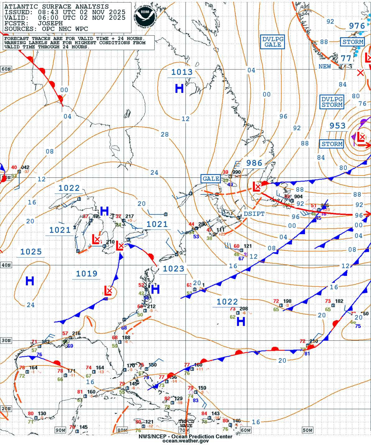
GEOS Local Image of north east
Edit Hide

Albany, NY,

NOTICE: Some pages have affiliate links to Amazon. As an Amazon Associate, I earn from qualifying purchases. Please read website Cookie, Privacy, and Disclamers by clicking HERE. To contact me click HERE. For my YouTube page click HERE
X