Marine Weather and Tide Forecast for Rainier, OR
 | Sunrise 7:00 AM Sunset 4:50 PM Moonrise 4:20 AM Moonset 3:21 PM |
Marine Forecasts
NOTE: Zones updated 4/16/2026. Some zones changed. Use Edit if needed.
PZZ210 Columbia River Bar- 539 Pm Pst Fri Nov 6 2026
.hazardous seas warning in effect through Saturday morning - .
.storm warning in effect from Saturday morning through late Saturday night - .
In the main channel -
General seas - 12 to 15 ft building to 14 to 16 ft Sunday morning.
First ebb - Ebb current of 3.8 kt at 248 am Saturday. Seas 12 to 15 ft.
SEcond ebb - Strong ebb current of 5.95 kt at 310 pm Saturday. Seas 12 to 14 ft.
Third ebb - Ebb current of 3.65 kt at 332 am Sunday. Seas 14 to 16 ft.
PZZ200 539 Pm Pst Fri Nov 6 2026
Synopsis for the southern washington and northern oregon coast - A series of storm systems will move through the waters through next week. A stronger system is expected Saturday afternoon through Saturday night, bringing high-end gale force to low-end storm force winds and hazardous seas to the coastal waters, with the strongest winds over the northern waters and columbia river bar. Winds weaken on Sunday, however an incoming westerly swell will push seas up to 20-25 ft, highest over the northern waters.
7 Day Forecast for Marine Location Near Rainier, OR

NEW! Add second zone forecast
| Longview Click for Map Note: See station comments in 'about' for disclaimers. Fri -- 12:52 AM PST 2.36 feet High Tide Fri -- 04:20 AM PST Moonrise Fri -- 06:59 AM PST Sunrise Fri -- 07:59 AM PST -0.75 feet Low Tide Fri -- 01:07 PM PST 3.59 feet High Tide Fri -- 03:20 PM PST Moonset Fri -- 04:50 PM PST Sunset Fri -- 08:58 PM PST -0.83 feet Low Tide Tide / Current data from XTide NOT FOR NAVIGATION |
Longview, Columbia River, Washington, Tide feet
| 12 am |
| 2.1 |
| 1 am |
| 2.4 |
| 2 am |
| 2.1 |
| 3 am |
| 1.6 |
| 4 am |
| 1 |
| 5 am |
| 0.5 |
| 6 am |
| -0 |
| 7 am |
| -0.5 |
| 8 am |
| -0.7 |
| 9 am |
| -0.4 |
| 10 am |
| 0.6 |
| 11 am |
| 2 |
| 12 pm |
| 3.1 |
| 1 pm |
| 3.6 |
| 2 pm |
| 3.3 |
| 3 pm |
| 2.7 |
| 4 pm |
| 2 |
| 5 pm |
| 1.3 |
| 6 pm |
| 0.7 |
| 7 pm |
| 0.1 |
| 8 pm |
| -0.6 |
| 9 pm |
| -0.8 |
| 10 pm |
| -0.5 |
| 11 pm |
| 0.5 |
| Walker Island Click for Map Flood direction 148 true Ebb direction 330 true Fri -- 12:37 AM PST 0.40 knots Max Flood Fri -- 01:27 AM PST -0.01 knots Slack Fri -- 04:20 AM PST Moonrise Fri -- 07:00 AM PST Sunrise Fri -- 07:03 AM PST -0.97 knots Max Ebb Fri -- 10:38 AM PST 0.00 knots Slack Fri -- 12:38 PM PST 0.45 knots Max Flood Fri -- 01:32 PM PST -0.00 knots Slack Fri -- 03:21 PM PST Moonset Fri -- 04:50 PM PST Sunset Fri -- 07:31 PM PST -1.39 knots Max Ebb Fri -- 11:44 PM PST 0.00 knots Slack Tide / Current data from XTide NOT FOR NAVIGATION |
Walker Island, south of (depth 12 ft), Washington Current, knots
| 12 am |
| 0.3 |
| 1 am |
| 0.3 |
| 2 am |
| -0.1 |
| 3 am |
| -0.4 |
| 4 am |
| -0.6 |
| 5 am |
| -0.8 |
| 6 am |
| -0.9 |
| 7 am |
| -1 |
| 8 am |
| -0.9 |
| 9 am |
| -0.6 |
| 10 am |
| -0.2 |
| 11 am |
| 0.1 |
| 12 pm |
| 0.4 |
| 1 pm |
| 0.4 |
| 2 pm |
| -0.2 |
| 3 pm |
| -0.5 |
| 4 pm |
| -0.8 |
| 5 pm |
| -1.1 |
| 6 pm |
| -1.3 |
| 7 pm |
| -1.4 |
| 8 pm |
| -1.4 |
| 9 pm |
| -1.1 |
| 10 pm |
| -0.7 |
| 11 pm |
| -0.3 |
FXUS66 KPQR 062345 AFDPQR
Area Forecast Discussion National Weather Service Portland OR 345 PM PST Fri Nov 6 2026
SYNOPSIS
An active weather pattern into next week will produce periods of rain and windy conditions. Saturday afternoon into the overnight hours will see strong winds along the coast and periods of moderate to heavy rainfall. A large westerly swell will bring high surf Sunday and an elevated threat of sneaker waves through the weekend.
DISCUSSION
Radar imagery Friday afternoon shows the next round of widespread rain spreading inland as the next weather system approaches the coast. Surface observations show winds have increased along the N OR and SW WA coast with gusts up to 35-45 mph. These gusts are expected to continue through the early evening as the surface front passes through. Showers will dissipate overnight, leading to dry weather by sunrise Saturday.
Saturday will be mostly dry across the area with slight shower chances lingering along the coast. Daytime temperatures will warm today and Saturday, peaking in the low 60s across the interior lowlands today, increasing to the mid to upper 60s on Saturday.
Attention then turns to the next weather system that will push a stronger front eastward into the region Saturday afternoon through Saturday night, leading to stronger southerly winds and more widespread rainfall. Latest NBM guidance has a 30-50% chance of wind gusts greater than 58 mph along the coast, and the REFS guidance has probabilities of 50-70% along coastal beaches and headlands. Winds will ramp up Saturday afternoon and remain elevated through the overnight hours, though some uncertainty remains in the exact timing during this period of when winds will peak. A High Wind Watch has been issued from 1 PM Saturday through 4 AM Sunday for the coast with the focus on exposed beaches, headlands, and other windy sites such as Clatsop Spit and Cape Disappointment.
Winds will then increase for the interior lowlands Saturday evening and overnight. Both the latest NBM and REFS guidance indicate there is a 20-40% chance at any given ASOS location of observing peak wind gusts to or above 40 mph Saturday evening, though the majority of wind gusts will likely be in the 20-30 mph range. A few downed tree limbs and isolated power outages are possible if gusts to exceed 40 mph, especially with trees that still have leaves.
Rainfall totals with the late Saturday storm system do not appear concerning for river flooding. There is a better signal for an intense enough narrow cold frontal rain band to materialize, but at this point, it still only appears there is a 15-25% chance for hourly rainfall totals exceeding a 0.25" per hour Saturday evening. This is typically the hourly rainfall amounts that are needed to produce nuisance urban flooding in October- December timeframe. However, with so many trees still leafed out, fallen leaves from a combination of the weather systems could clog gutters, allowing lower rain rates to produce isolated roadway flooding. The main band of rain is expected to pass through the area by early Sunday morning with scattered post-frontal showers continuing into the day along with mostly cloudy skies and cooler daytime temperatures.
Looking at next week, ensembles are in agreement that the progressive pattern will continue, but there is high uncertainty in the details on potential weather systems and therefore exact timing and magnitude of winds and rainfall. Euro and Canadian ensemble members are in general agreement that the next weather system will return rain sometime Monday into Tuesday, but the GEFS members are much more uncertain. There's another signal with all three ensemble systems in another weather system sometime late week or in the weekend. Fortunately, any signs of an overly impactful wind or rain event in the global ensembles is still relatively low (10-20% chance or less) at this point, though will need to keep an eye on flooding concerns depending on the strength of these weather systems as soils become more saturated from multiple rounds of rain. -03
AVIATION
Through 00Z Saturday...Radar and terminal observations as of early Friday afternoon depicts a frontal system pushing through the region, bringing rain, MVFR CIGs at the coast, and low-end VFR CIGs across the Willamette Valley. Expect these trends to continue through this evening as the front progresses inland.
Areas in the southern Valley like KEUG may get less rain given that the front is tracking a little further north. After 00-03z Sat, chances for MVFR CIGs are around 30-60% at any given hour through at least 15-18z Sat across the Valley, with the highest chances across the central and northern Valley.
As the front dies and lifts northward tonight, there may be some increasing cloud breaks. However, there is low confidence at this time for any widespread LIFR conditions due to fog. If anything, there could at least be some patchy fog across the Valley.
Chances for LIFR conditions due to fog are around 15-35% at any given hour between 11-17z Sat for Valley terminals. Otherwise, CIGs trend IFR/low-end MVFR along the coast, and high-end MVFR for the Valley. Southerly winds continue for most terminals through this evening gusts up to 25 kt along the coast, and around 10 kt or less across the Valley. An exception would be light east winds at KTTD.
KPDX AND APPROACHES...Predominately VFR conditions through 00-03z Sat with light showers. After 03z Sat, there is a 40-60% chance for MVFR CIGs at any given hour through at least 15-18z Sat.
Southerly winds around 7-10 kt turn east/southeasterly around 4-7 kt after 02-03z Sat. -10
MARINE
An active weather pattern will continue across the waters into next week. Southerly winds with gale force wind gusts up to 35 kt continue through this afternoon as the current front pushes through the waters. Afterwards, winds will quickly weaken below 15 kt behind the front this evening and overnight. However, a persistent westerly swell will maintain steep and hazardous seas of 14 to 17 ft through Saturday morning. Therefore, a Hazardous Seas Warning remains in effect through 10 AM Sat across all waters including the Columbia River Bar.
The next stronger front moves eastward across the waters late Saturday morning through late Saturday night. There is high confidence (>90% chance) for high-end gale force wind gusts of 40-45 kt across the waters Saturday evening. For the waters north of Cape Falcon there is a 50-70% chance at any given hour between 3-9 PM Sat for storm force wind gusts up to 50-55 kt. A result, a Storm Force Warning has been issued for all waters north of Cape Falcon including the Columbia River Bar from 10 AM Sat to 4 AM Sun. Behind this front, winds quickly die off and fall below 20 kt after 10 AM Sun.
A large westerly swell will also push into the waters on Sunday with high confidence for seas exceeding 20 ft. Latest guidance suggests seas peak between 20 to 25 ft between 1 AM to 7 PM Sun.
There is a 20-40% chance for seas exceeding 25 ft in the outer waters beyond 30 NM and north of Cape Foulweather. Seas gradually subside Sunday night into Monday. A series of weather systems will continue next week, impacting the waters and bringing additional rounds of small craft and gale conditions. -10
BEACH HAZARDS
A westerly swell of 14-16 ft with a dominant period of 15-16 seconds will continue to push onto the coast this afternoon/evening and maintain a high threat for sneaker waves. This threat will persist through Saturday. The Beach Hazards Statement remains in effect through 0400 Sunday.
On Sunday, there is high confidence for an even larger westerly swell of 20-25 ft with a dominant period of 15-17 seconds which will impact the coast. Due to the steepness and energy of this swell, a High Surf Advisory has been issued for the entire coast from 0400 to 2200 Sun. Expect large waves with breakers up to 28 ft, hazardous surf conditions, and a continued high threat for sneaker waves. It is advised to either avoid or use a lot of caution if you plan to recreate on area beaches and jetties on Sunday, including those who are razor clamming. High surf will stand the highest chance of producing damage along the coast around high tide on Sunday, which will occur around 11 AM to 12 PM for the north Oregon coast. -10
PQR WATCHES/WARNINGS/ADVISORIES
OR...High Wind Watch from Saturday afternoon through late Saturday night for ORZ101>103.
High Surf Advisory from 4 AM to 10 PM PST Sunday for ORZ101>103.
WA...High Wind Watch from Saturday afternoon through late Saturday night for WAZ201.
High Surf Advisory from 4 AM to 10 PM PST Sunday for WAZ201.
PZ...Gale Warning until 4 PM PST this afternoon for PZZ210-251-271.
Hazardous Seas Warning until 10 AM PST Saturday for PZZ210-251- 271.
Storm Warning from 10 AM Saturday to 4 AM PST Sunday for PZZ210- 251-271.
Hazardous Seas Warning until 10 AM PST Saturday for PZZ252-253- 272-273.
Gale Warning from 10 AM Saturday to 4 AM PST Sunday for PZZ252- 253-272-273.
Area Forecast Discussion National Weather Service Portland OR 345 PM PST Fri Nov 6 2026
SYNOPSIS
An active weather pattern into next week will produce periods of rain and windy conditions. Saturday afternoon into the overnight hours will see strong winds along the coast and periods of moderate to heavy rainfall. A large westerly swell will bring high surf Sunday and an elevated threat of sneaker waves through the weekend.
DISCUSSION
Radar imagery Friday afternoon shows the next round of widespread rain spreading inland as the next weather system approaches the coast. Surface observations show winds have increased along the N OR and SW WA coast with gusts up to 35-45 mph. These gusts are expected to continue through the early evening as the surface front passes through. Showers will dissipate overnight, leading to dry weather by sunrise Saturday.
Saturday will be mostly dry across the area with slight shower chances lingering along the coast. Daytime temperatures will warm today and Saturday, peaking in the low 60s across the interior lowlands today, increasing to the mid to upper 60s on Saturday.
Attention then turns to the next weather system that will push a stronger front eastward into the region Saturday afternoon through Saturday night, leading to stronger southerly winds and more widespread rainfall. Latest NBM guidance has a 30-50% chance of wind gusts greater than 58 mph along the coast, and the REFS guidance has probabilities of 50-70% along coastal beaches and headlands. Winds will ramp up Saturday afternoon and remain elevated through the overnight hours, though some uncertainty remains in the exact timing during this period of when winds will peak. A High Wind Watch has been issued from 1 PM Saturday through 4 AM Sunday for the coast with the focus on exposed beaches, headlands, and other windy sites such as Clatsop Spit and Cape Disappointment.
Winds will then increase for the interior lowlands Saturday evening and overnight. Both the latest NBM and REFS guidance indicate there is a 20-40% chance at any given ASOS location of observing peak wind gusts to or above 40 mph Saturday evening, though the majority of wind gusts will likely be in the 20-30 mph range. A few downed tree limbs and isolated power outages are possible if gusts to exceed 40 mph, especially with trees that still have leaves.
Rainfall totals with the late Saturday storm system do not appear concerning for river flooding. There is a better signal for an intense enough narrow cold frontal rain band to materialize, but at this point, it still only appears there is a 15-25% chance for hourly rainfall totals exceeding a 0.25" per hour Saturday evening. This is typically the hourly rainfall amounts that are needed to produce nuisance urban flooding in October- December timeframe. However, with so many trees still leafed out, fallen leaves from a combination of the weather systems could clog gutters, allowing lower rain rates to produce isolated roadway flooding. The main band of rain is expected to pass through the area by early Sunday morning with scattered post-frontal showers continuing into the day along with mostly cloudy skies and cooler daytime temperatures.
Looking at next week, ensembles are in agreement that the progressive pattern will continue, but there is high uncertainty in the details on potential weather systems and therefore exact timing and magnitude of winds and rainfall. Euro and Canadian ensemble members are in general agreement that the next weather system will return rain sometime Monday into Tuesday, but the GEFS members are much more uncertain. There's another signal with all three ensemble systems in another weather system sometime late week or in the weekend. Fortunately, any signs of an overly impactful wind or rain event in the global ensembles is still relatively low (10-20% chance or less) at this point, though will need to keep an eye on flooding concerns depending on the strength of these weather systems as soils become more saturated from multiple rounds of rain. -03
AVIATION
Through 00Z Saturday...Radar and terminal observations as of early Friday afternoon depicts a frontal system pushing through the region, bringing rain, MVFR CIGs at the coast, and low-end VFR CIGs across the Willamette Valley. Expect these trends to continue through this evening as the front progresses inland.
Areas in the southern Valley like KEUG may get less rain given that the front is tracking a little further north. After 00-03z Sat, chances for MVFR CIGs are around 30-60% at any given hour through at least 15-18z Sat across the Valley, with the highest chances across the central and northern Valley.
As the front dies and lifts northward tonight, there may be some increasing cloud breaks. However, there is low confidence at this time for any widespread LIFR conditions due to fog. If anything, there could at least be some patchy fog across the Valley.
Chances for LIFR conditions due to fog are around 15-35% at any given hour between 11-17z Sat for Valley terminals. Otherwise, CIGs trend IFR/low-end MVFR along the coast, and high-end MVFR for the Valley. Southerly winds continue for most terminals through this evening gusts up to 25 kt along the coast, and around 10 kt or less across the Valley. An exception would be light east winds at KTTD.
KPDX AND APPROACHES...Predominately VFR conditions through 00-03z Sat with light showers. After 03z Sat, there is a 40-60% chance for MVFR CIGs at any given hour through at least 15-18z Sat.
Southerly winds around 7-10 kt turn east/southeasterly around 4-7 kt after 02-03z Sat. -10
MARINE
An active weather pattern will continue across the waters into next week. Southerly winds with gale force wind gusts up to 35 kt continue through this afternoon as the current front pushes through the waters. Afterwards, winds will quickly weaken below 15 kt behind the front this evening and overnight. However, a persistent westerly swell will maintain steep and hazardous seas of 14 to 17 ft through Saturday morning. Therefore, a Hazardous Seas Warning remains in effect through 10 AM Sat across all waters including the Columbia River Bar.
The next stronger front moves eastward across the waters late Saturday morning through late Saturday night. There is high confidence (>90% chance) for high-end gale force wind gusts of 40-45 kt across the waters Saturday evening. For the waters north of Cape Falcon there is a 50-70% chance at any given hour between 3-9 PM Sat for storm force wind gusts up to 50-55 kt. A result, a Storm Force Warning has been issued for all waters north of Cape Falcon including the Columbia River Bar from 10 AM Sat to 4 AM Sun. Behind this front, winds quickly die off and fall below 20 kt after 10 AM Sun.
A large westerly swell will also push into the waters on Sunday with high confidence for seas exceeding 20 ft. Latest guidance suggests seas peak between 20 to 25 ft between 1 AM to 7 PM Sun.
There is a 20-40% chance for seas exceeding 25 ft in the outer waters beyond 30 NM and north of Cape Foulweather. Seas gradually subside Sunday night into Monday. A series of weather systems will continue next week, impacting the waters and bringing additional rounds of small craft and gale conditions. -10
BEACH HAZARDS
A westerly swell of 14-16 ft with a dominant period of 15-16 seconds will continue to push onto the coast this afternoon/evening and maintain a high threat for sneaker waves. This threat will persist through Saturday. The Beach Hazards Statement remains in effect through 0400 Sunday.
On Sunday, there is high confidence for an even larger westerly swell of 20-25 ft with a dominant period of 15-17 seconds which will impact the coast. Due to the steepness and energy of this swell, a High Surf Advisory has been issued for the entire coast from 0400 to 2200 Sun. Expect large waves with breakers up to 28 ft, hazardous surf conditions, and a continued high threat for sneaker waves. It is advised to either avoid or use a lot of caution if you plan to recreate on area beaches and jetties on Sunday, including those who are razor clamming. High surf will stand the highest chance of producing damage along the coast around high tide on Sunday, which will occur around 11 AM to 12 PM for the north Oregon coast. -10
PQR WATCHES/WARNINGS/ADVISORIES
OR...High Wind Watch from Saturday afternoon through late Saturday night for ORZ101>103.
High Surf Advisory from 4 AM to 10 PM PST Sunday for ORZ101>103.
WA...High Wind Watch from Saturday afternoon through late Saturday night for WAZ201.
High Surf Advisory from 4 AM to 10 PM PST Sunday for WAZ201.
PZ...Gale Warning until 4 PM PST this afternoon for PZZ210-251-271.
Hazardous Seas Warning until 10 AM PST Saturday for PZZ210-251- 271.
Storm Warning from 10 AM Saturday to 4 AM PST Sunday for PZZ210- 251-271.
Hazardous Seas Warning until 10 AM PST Saturday for PZZ252-253- 272-273.
Gale Warning from 10 AM Saturday to 4 AM PST Sunday for PZZ252- 253-272-273.
| Stations | Dist | Age | Wind | Air | Water | Waves | inHg | DewPt |
| LOPW1 - 9440422 - Longview, WA | 0 mi | 55 min | 56°F | 30.17 | ||||
| KLMW1 | 10 mi | 55 min | 30.17 | |||||
| ASTO3 - 9439040 - Astoria, OR | 44 mi | 55 min | S 7G | 56°F |
Wind History for Astoria, OR
toggle option: (graph/table)
Link to 5 hour of 5 minute data for KKLS
Terminal Aerodrome Forecast (TAF) for KKLS
Wind History Graph: KLS
(wind in knots)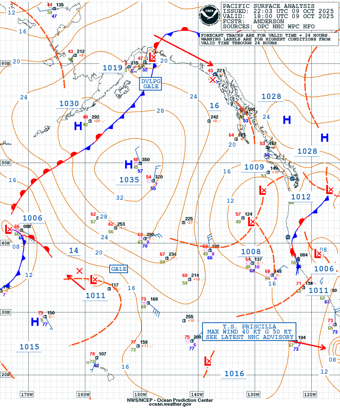
GEOS Local Image of Pacific Northwest
Edit Hide

Portland, OR,

NOTICE: Some pages have affiliate links to Amazon. As an Amazon Associate, I earn from qualifying purchases. Please read website Cookie, Privacy, and Disclamers by clicking HERE. To contact me click HERE. For my YouTube page click HERE
X