Marine Weather and Tide Forecast for Long Beach, WA
 | Sunrise 7:01 AM Sunset 7:15 PM Moonrise 4:17 PM Moonset 12:15 AM |
Marine Forecasts
NOTE: Zones updated 4/16/2026. Some zones changed. Use Edit if needed.
PZZ251 Coastal Waters From Cape Shoalwater Wa To Cape Falcon Or Out 10 Nm- 227 Pm Pdt Mon Sep 21 2026
This afternoon - NW wind around 5 kt. Seas 5 to 6 ft. Wave detail: W 6 ft at 12 seconds and sw 2 ft at 18 seconds.
Tonight - NW wind 5 to 10 kt. Seas 5 to 7 ft. Wave detail: nw 2 ft at 4 seconds, W 6 ft at 13 seconds and sw 2 ft at 17 seconds.
Tue - NW wind 5 to 10 kt. Seas 5 to 7 ft. Wave detail: nw 2 ft at 4 seconds, W 6 ft at 12 seconds and sw 2 ft at 17 seconds.
Tue night - SW wind around 5 kt, backing to S after midnight. Seas around 5 ft. Wave detail: W 5 ft at 11 seconds and sw 2 ft at 17 seconds.
Wed - S wind 5 to 10 kt, veering to W in the afternoon. Seas 5 to 7 ft. Wave detail: nw 2 ft at 4 seconds, W 7 ft at 11 seconds and sw 2 ft at 16 seconds.
Wed night - N wind 10 to 15 kt. Seas 6 to 8 ft. Wave detail: N 3 ft at 4 seconds, nw 7 ft at 11 seconds and sw 2 ft at 15 seconds. A chance of rain after midnight.
Thu - N wind 5 to 10 kt. Seas 5 to 7 ft. Wave detail: N 2 ft at 4 seconds, nw 6 ft at 10 seconds and sw 2 ft at 15 seconds. A chance of rain in the morning, then rain likely in the afternoon.
Thu night - NW wind 10 to 15 kt. Seas 5 to 7 ft. Wave detail: nw 3 ft at 4 seconds, nw 6 ft at 10 seconds and sw 2 ft at 15 seconds. Rain likely.
Fri - NW wind 10 to 15 kt. Seas 5 to 7 ft. Wave detail: nw 3 ft at 4 seconds, nw 6 ft at 10 seconds and sw 2 ft at 14 seconds. A chance of rain in the morning.
Fri night - NW wind 15 to 20 kt, becoming N 10 to 15 kt after midnight. Seas 6 to 7 ft. Wave detail: nw 3 ft at 5 seconds, nw 6 ft at 10 seconds and sw 2 ft at 10 seconds.
PZZ200 227 Pm Pdt Mon Sep 21 2026
Synopsis for the southern washington and northern oregon coast - High pressure will maintain northerly winds across the waters through Thursday. Winds become more northwesterly and increase slightly in strength Thursday night into Friday with the passage of a cold front. Seas increase to 6 to 8 ft late Monday night and then remain near that range through Friday.
7 Day Forecast for Marine Location Near Long Beach, WA

NEW! Add second zone forecast
| Tarlatt Slough Click for Map Mon -- 01:15 AM PDT Moonset Mon -- 05:03 AM PDT 1.03 feet Low Tide Mon -- 07:02 AM PDT Sunrise Mon -- 11:13 AM PDT 6.62 feet High Tide Mon -- 05:09 PM PDT 3.69 feet Low Tide Mon -- 05:17 PM PDT Moonrise Mon -- 07:15 PM PDT Sunset Mon -- 10:33 PM PDT 7.56 feet High Tide Tide / Current data from XTide NOT FOR NAVIGATION |
Tarlatt Slough, Willapa Bay, Washington, Tide feet
| 12 am |
| 5.7 |
| 1 am |
| 4.6 |
| 2 am |
| 3.5 |
| 3 am |
| 2.4 |
| 4 am |
| 1.4 |
| 5 am |
| 1 |
| 6 am |
| 1.4 |
| 7 am |
| 2.3 |
| 8 am |
| 3.4 |
| 9 am |
| 4.8 |
| 10 am |
| 6 |
| 11 am |
| 6.6 |
| 12 pm |
| 6.5 |
| 1 pm |
| 6 |
| 2 pm |
| 5.5 |
| 3 pm |
| 4.8 |
| 4 pm |
| 4.1 |
| 5 pm |
| 3.7 |
| 6 pm |
| 4 |
| 7 pm |
| 4.9 |
| 8 pm |
| 5.8 |
| 9 pm |
| 6.7 |
| 10 pm |
| 7.4 |
| 11 pm |
| 7.5 |
| Baker Bay entrance Click for Map Flood direction 8 true Ebb direction 202 true Mon -- 01:16 AM PDT Moonset Mon -- 01:18 AM PDT -0.68 knots Max Ebb Mon -- 05:11 AM PDT 0.00 knots Slack Mon -- 07:01 AM PDT Sunrise Mon -- 08:33 AM PDT 0.83 knots Max Flood Mon -- 11:11 AM PDT -0.00 knots Slack Mon -- 02:04 PM PDT -0.40 knots Max Ebb Mon -- 05:09 PM PDT 0.00 knots Slack Mon -- 05:16 PM PDT Moonrise Mon -- 07:15 PM PDT Sunset Mon -- 08:20 PM PDT 0.48 knots Max Flood Mon -- 10:26 PM PDT -0.00 knots Slack Tide / Current data from XTide NOT FOR NAVIGATION |
Baker Bay entrance, E of Sand Island Tower (depth 23 ft), Oregon Current, knots
| 12 am |
| -0.6 |
| 1 am |
| -0.7 |
| 2 am |
| -0.6 |
| 3 am |
| -0.5 |
| 4 am |
| -0.2 |
| 5 am |
| -0 |
| 6 am |
| 0.3 |
| 7 am |
| 0.6 |
| 8 am |
| 0.8 |
| 9 am |
| 0.8 |
| 10 am |
| 0.5 |
| 11 am |
| 0.1 |
| 12 pm |
| -0.2 |
| 1 pm |
| -0.3 |
| 2 pm |
| -0.4 |
| 3 pm |
| -0.3 |
| 4 pm |
| -0.2 |
| 5 pm |
| -0 |
| 6 pm |
| 0.2 |
| 7 pm |
| 0.4 |
| 8 pm |
| 0.5 |
| 9 pm |
| 0.4 |
| 10 pm |
| 0.2 |
| 11 pm |
| -0.2 |
FXUS66 KPQR 212155 AFDPQR
Area Forecast Discussion National Weather Service Portland OR 255 PM PDT Mon Sep 21 2026
SYNOPSIS
Mainly dry and seasonable weather expected through at least Wednesday as onshore flow persists. Temperatures gradually trend trend cooler through the week with areas of morning fog and low clouds giving way to afternoon sun. Upper level troughing over the Gulf of Alaska deepens on Thursday, approaching the region through Friday, bringing increasing chances for widespread rain.
Conditions expected to trend drier on Saturday with chances for rain returning late weekend into early next week.
SHORT TERM
Now through Wednesday night...Satellite imagery this afternoon shows low stratus beginning to clear, which will allow for inland temperatures to warm into the mid-70s today. Expect dry weather with near to slightly below normal temperatures to continue through Wednesday as areas of morning fog and low clouds give way to increasing afternoon sun. Despite the lack of precipitation, 500 mb heights and temperatures aloft will be on a gradual decrease as the trough begins to deepen towards the middle of the week. Temperatures cool slightly through the next 2 days, with daily highs in the lower 70s across inland valleys and 60s at the coast. Morning lows will generally range anywhere from the mid 40s to mid 50s, warmest over urban areas and coolest over rural areas.
Model ensemble guidance remains in good agreement for increasing southwest to westerly flow aloft ahead of broad upper level troughing over the Gulf of Alaska. A frontal system will remain north of our area, mainly impacting the British Columbia coast through mid-week. The only potential exception to that is Tuesday night through Wednesday morning along the south Washington and far north Oregon coast when there is a very low chance (5-10%) for light rain with an initial weak wave and attendant decaying surface front.
DH/23
LONG TERM
Thursday through Monday...Rain is appearing more likely later this week as more amplified upper level troughing interacts with a plume of moisture over the Pacific. By Thursday, a strong jet streak will cause the upper trough over the Gulf of Alaska to dig southward, becoming more amplified off the coast of the Pacific NW.
This will interact with an area of weak low pressure associated with a plume of moisture, potentially strengthening the surface low as it moves toward the coast. But, there still remains quite a bit of uncertainty regarding the positioning and strength of this low pressure system.
First, will discuss the precipitation potential, as the probabilities for rain continue to increase across the area for later Thursday into Friday. Latest NBM guidance suggests there is at least an 80% chance for measurable rainfall across NW Oregon and SW Washington, but rainfall amounts remain quite uncertain, though have been trending higher in the latest model runs. There is still a 10- 20% chance that conditions remain dry. There is also a 10% chance that 24-hour rainfall amounts exceed 1 inch anywhere across the forecast area. Those with outdoor plans late Thursday or Friday should monitor the forecast over the coming days to see if rain chances trend up or down.
While the probability for impactful wind with this system is small, it is still worth noting. A handful of ensemble members, including the latest 12z ECMWF operational run, develops a slightly stronger low that lifts NE toward the northern OR coast. There is around a 10% chance for wind gusts exceeding 40 mph along the coast and within the central Willamette Valley.
Upper-level heights look to rebound quickly in the wake of the shortwave trough, with high confidence for dry weather and slightly warmer temperatures on Saturday given chances for rain fall below 10%. However, high pressure building in behind this trough Friday night into the weekend will bring clearing skies and calm winds during the overnight hours. This will bring an ideal set-up for radiational cooling and chillier overnight low temperatures. Aside from the high Cascades, overnight lows will be coldest in the Upper Hood River Valley where frost development is possible Friday night, Saturday night, and Sunday night. The NBM is showing a 30-50% chance for morning lows below 36-37 degrees Friday night and Saturday night near Parkdale and a 5-10% chance near Odell. Those with outdoor vegetation that is susceptible to frost damage should monitor the forecast over the coming days.
Chances for precipitation return Sunday into Monday next week, but there exists quite a bit of uncertainty between the clusters with some indicating weak ridging building in but others maintains more zonal to weak troughing persisting. DH/23
AVIATION
Through 18Z Tuesday...Low stratus has dissipated across the area, giving way to mainly VFR conditions. High level clouds streaming in along southwesterly upper level flow will continue as a weak front moves through. VFR conditions persist until the evening with northerly to northwesterly winds 5-10 kt. Conditions this evening are expected to be similar to the past few evenings with stratus developing between 00-06z Tuesday and spreading through the coast range gaps and along the Columbia river into the metro and Willamette Valley between 08-12z Tuesday.
KPDX AND APPROACHES...Low clouds have dissipated with some high level clouds moving over the area. Northerly winds around 5 kt expected. Stratus develops and pushes eastward again late tonight into Tuesday morning with a period MVFR CIGs likely (60-70%). -19
MARINE
High pressure will maintain predominately northerly winds across the waters through Thursday. An exception would be Tuesday afternoon to Wednesday morning, when winds may turn more westerly for the waters north of Cape Falcon with the passage of a weak front. Winds become more northwesterly and increase slightly in strength over all of the coastal waters Thursday night into Friday with the passage of another front. This front will be relatively stronger than the frontal passage earlier in the week, with widespread rain likely. Wind gusts should generally stay below 20 kt through the week. The highest probabilities come late Thursday into Friday with a 15-40% chance, highest in the northern outer waters.
Seas are expected to increase to 6 to 8 ft this evening into the overnight with the arrival of a long period west- northwesterly swell. Seas then remain near that range through Friday, but are not expected to be particularly steep at any point in time due to the dominant wave periods of 10 to 13 seconds.
-19/23
PQR WATCHES/WARNINGS/ADVISORIES
OR...None.
WA...None.
PZ...None.
Area Forecast Discussion National Weather Service Portland OR 255 PM PDT Mon Sep 21 2026
SYNOPSIS
Mainly dry and seasonable weather expected through at least Wednesday as onshore flow persists. Temperatures gradually trend trend cooler through the week with areas of morning fog and low clouds giving way to afternoon sun. Upper level troughing over the Gulf of Alaska deepens on Thursday, approaching the region through Friday, bringing increasing chances for widespread rain.
Conditions expected to trend drier on Saturday with chances for rain returning late weekend into early next week.
SHORT TERM
Now through Wednesday night...Satellite imagery this afternoon shows low stratus beginning to clear, which will allow for inland temperatures to warm into the mid-70s today. Expect dry weather with near to slightly below normal temperatures to continue through Wednesday as areas of morning fog and low clouds give way to increasing afternoon sun. Despite the lack of precipitation, 500 mb heights and temperatures aloft will be on a gradual decrease as the trough begins to deepen towards the middle of the week. Temperatures cool slightly through the next 2 days, with daily highs in the lower 70s across inland valleys and 60s at the coast. Morning lows will generally range anywhere from the mid 40s to mid 50s, warmest over urban areas and coolest over rural areas.
Model ensemble guidance remains in good agreement for increasing southwest to westerly flow aloft ahead of broad upper level troughing over the Gulf of Alaska. A frontal system will remain north of our area, mainly impacting the British Columbia coast through mid-week. The only potential exception to that is Tuesday night through Wednesday morning along the south Washington and far north Oregon coast when there is a very low chance (5-10%) for light rain with an initial weak wave and attendant decaying surface front.
DH/23
LONG TERM
Thursday through Monday...Rain is appearing more likely later this week as more amplified upper level troughing interacts with a plume of moisture over the Pacific. By Thursday, a strong jet streak will cause the upper trough over the Gulf of Alaska to dig southward, becoming more amplified off the coast of the Pacific NW.
This will interact with an area of weak low pressure associated with a plume of moisture, potentially strengthening the surface low as it moves toward the coast. But, there still remains quite a bit of uncertainty regarding the positioning and strength of this low pressure system.
First, will discuss the precipitation potential, as the probabilities for rain continue to increase across the area for later Thursday into Friday. Latest NBM guidance suggests there is at least an 80% chance for measurable rainfall across NW Oregon and SW Washington, but rainfall amounts remain quite uncertain, though have been trending higher in the latest model runs. There is still a 10- 20% chance that conditions remain dry. There is also a 10% chance that 24-hour rainfall amounts exceed 1 inch anywhere across the forecast area. Those with outdoor plans late Thursday or Friday should monitor the forecast over the coming days to see if rain chances trend up or down.
While the probability for impactful wind with this system is small, it is still worth noting. A handful of ensemble members, including the latest 12z ECMWF operational run, develops a slightly stronger low that lifts NE toward the northern OR coast. There is around a 10% chance for wind gusts exceeding 40 mph along the coast and within the central Willamette Valley.
Upper-level heights look to rebound quickly in the wake of the shortwave trough, with high confidence for dry weather and slightly warmer temperatures on Saturday given chances for rain fall below 10%. However, high pressure building in behind this trough Friday night into the weekend will bring clearing skies and calm winds during the overnight hours. This will bring an ideal set-up for radiational cooling and chillier overnight low temperatures. Aside from the high Cascades, overnight lows will be coldest in the Upper Hood River Valley where frost development is possible Friday night, Saturday night, and Sunday night. The NBM is showing a 30-50% chance for morning lows below 36-37 degrees Friday night and Saturday night near Parkdale and a 5-10% chance near Odell. Those with outdoor vegetation that is susceptible to frost damage should monitor the forecast over the coming days.
Chances for precipitation return Sunday into Monday next week, but there exists quite a bit of uncertainty between the clusters with some indicating weak ridging building in but others maintains more zonal to weak troughing persisting. DH/23
AVIATION
Through 18Z Tuesday...Low stratus has dissipated across the area, giving way to mainly VFR conditions. High level clouds streaming in along southwesterly upper level flow will continue as a weak front moves through. VFR conditions persist until the evening with northerly to northwesterly winds 5-10 kt. Conditions this evening are expected to be similar to the past few evenings with stratus developing between 00-06z Tuesday and spreading through the coast range gaps and along the Columbia river into the metro and Willamette Valley between 08-12z Tuesday.
KPDX AND APPROACHES...Low clouds have dissipated with some high level clouds moving over the area. Northerly winds around 5 kt expected. Stratus develops and pushes eastward again late tonight into Tuesday morning with a period MVFR CIGs likely (60-70%). -19
MARINE
High pressure will maintain predominately northerly winds across the waters through Thursday. An exception would be Tuesday afternoon to Wednesday morning, when winds may turn more westerly for the waters north of Cape Falcon with the passage of a weak front. Winds become more northwesterly and increase slightly in strength over all of the coastal waters Thursday night into Friday with the passage of another front. This front will be relatively stronger than the frontal passage earlier in the week, with widespread rain likely. Wind gusts should generally stay below 20 kt through the week. The highest probabilities come late Thursday into Friday with a 15-40% chance, highest in the northern outer waters.
Seas are expected to increase to 6 to 8 ft this evening into the overnight with the arrival of a long period west- northwesterly swell. Seas then remain near that range through Friday, but are not expected to be particularly steep at any point in time due to the dominant wave periods of 10 to 13 seconds.
-19/23
PQR WATCHES/WARNINGS/ADVISORIES
OR...None.
WA...None.
PZ...None.
| Stations | Dist | Age | Wind | Air | Water | Waves | inHg | DewPt |
| 46243 - Clatsop Spit, OR - 162 | 11 mi | 97 min | 61°F | 61°F | 4 ft | |||
| ASTO3 - 9439040 - Astoria, OR | 19 mi | 49 min | NW 12G | 62°F | 63°F | |||
| TOKW1 - 9440910 - Toke Point, WA | 24 mi | 49 min | WNW 11G | 62°F | 63°F | 30.04 | ||
| 46029 - COL RIVER BAR - 20NM West of Columbia River Mouth | 29 mi | 77 min | NW 1.9G | 62°F | 60°F | 8 ft | 30.04 | |
| 46211 - Grays Harbor, WA (036) | 35 mi | 101 min | 61°F | 6 ft | ||||
| 46248 - Astoria Canyon, OR (179) | 35 mi | 71 min | 62°F | 9 ft | ||||
| WPTW1 - 9441102 - Westport, WA | 37 mi | 91 min | WNW 7G | 60°F | 60°F | 30.03 |
Wind History for Astoria, OR
toggle option: (graph/table)
Link to 5 hour of 5 minute data for KAST
Terminal Aerodrome Forecast (TAF) for KAST
Wind History Graph: AST
(wind in knots)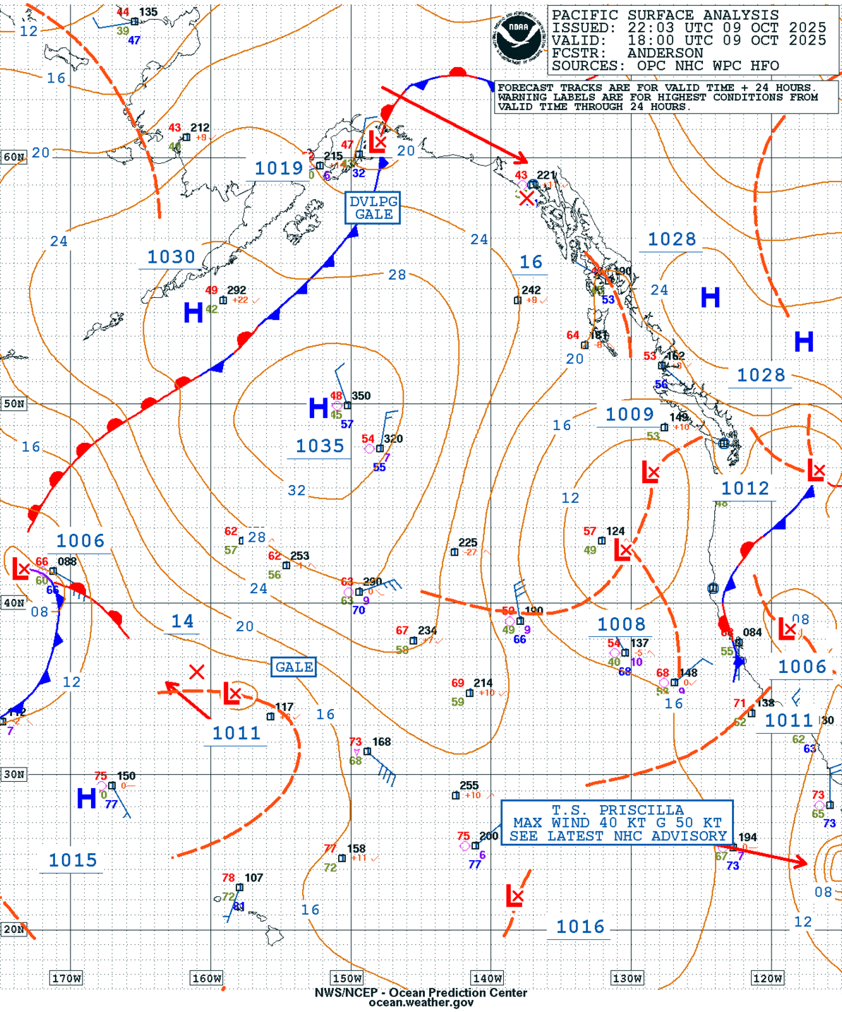
GEOS Local Image of Pacific Northwest
Edit Hide

Langley,Hill/Gray,Harbor,WA

NOTICE: Some pages have affiliate links to Amazon. As an Amazon Associate, I earn from qualifying purchases. Please read website Cookie, Privacy, and Disclamers by clicking HERE. To contact me click HERE. For my YouTube page click HERE
X