Marine Weather and Tide Forecast for Fife Heights, WA
 | Sunrise 6:27 AM Sunset 7:51 PM Moonrise 7:59 PM Moonset 9:38 AM |
Marine Forecasts
NOTE: Zones updated 4/16/2026. Some zones changed. Use Edit if needed.
PZZ135 Puget Sound And Hood Canal- 139 Am Pdt Mon Aug 31 2026
Today - N wind 5 to 10 kt. Waves around 2 ft or less.
Tonight - N wind 5 to 10 kt, easing to around 5 kt after midnight. Waves around 2 ft or less.
Tue - S wind around 5 kt, veering to sw 10 to 15 kt in the afternoon. Waves around 2 ft or less.
Tue night - SW wind 10 to 15 kt, becoming S 15 to 20 kt after midnight. Waves around 2 ft or less. A chance of rain after midnight.
Wed - S wind 10 to 15 kt, rising to 15 to 20 kt in the afternoon. Waves around 2 ft or less. Rain.
Wed night - S wind 15 to 20 kt. Waves around 2 ft or less. Rain.
Thu - S wind 10 to 15 kt. Waves around 2 ft or less. Rain likely in the morning, then showers likely in the afternoon.
Thu night - S wind around 5 kt. Waves around 2 ft or less. A chance of rain in the evening.
Fri - S wind around 5 kt. Waves around 2 ft or less. A chance of rain in the afternoon.
Fri night - N wind around 5 kt. Waves around 2 ft or less.
PZZ100 139 Am Pdt Mon Aug 31 2026
Synopsis for the northern and central washington coastal and inland waters - Brief high pressure will hang over the waters Monday into early Tuesday. A strong low pressure and frontal system remain on track to pass through the waters Wednesday into Thursday, with potential for gusts up to gale force over portions of the waters.
7 Day Forecast for Marine Location Near Fife Heights, WA

NEW! Add second zone forecast
| Tacoma Click for Map Mon -- 01:35 AM PDT 1.78 feet Low Tide Mon -- 06:27 AM PDT Sunrise Mon -- 07:37 AM PDT 10.40 feet High Tide Mon -- 10:38 AM PDT Moonset Mon -- 01:33 PM PDT 2.89 feet Low Tide Mon -- 07:43 PM PDT 12.03 feet High Tide Mon -- 07:51 PM PDT Sunset Mon -- 08:58 PM PDT Moonrise Tide / Current data from XTide NOT FOR NAVIGATION |
Tacoma, Commencement Bay, Sitcum Waterway, Puget Sound, Washington, Tide feet
| 12 am |
| 3.4 |
| 1 am |
| 2 |
| 2 am |
| 1.9 |
| 3 am |
| 3 |
| 4 am |
| 5 |
| 5 am |
| 7.2 |
| 6 am |
| 9.1 |
| 7 am |
| 10.2 |
| 8 am |
| 10.3 |
| 9 am |
| 9.5 |
| 10 am |
| 7.9 |
| 11 am |
| 6 |
| 12 pm |
| 4.2 |
| 1 pm |
| 3.1 |
| 2 pm |
| 3 |
| 3 pm |
| 4.1 |
| 4 pm |
| 6.1 |
| 5 pm |
| 8.4 |
| 6 pm |
| 10.4 |
| 7 pm |
| 11.7 |
| 8 pm |
| 12 |
| 9 pm |
| 11.1 |
| 10 pm |
| 9.2 |
| 11 pm |
| 6.7 |
| Browns Point Click for Map Flood direction 234 true Ebb direction 42 true Mon -- 12:34 AM PDT 0.00 knots Slack Mon -- 05:12 AM PDT 0.60 knots Max Flood Mon -- 06:27 AM PDT Sunrise Mon -- 09:07 AM PDT -0.00 knots Slack Mon -- 10:38 AM PDT Moonset Mon -- 11:30 AM PDT -0.28 knots Max Ebb Mon -- 02:11 PM PDT 0.00 knots Slack Mon -- 06:03 PM PDT 0.74 knots Max Flood Mon -- 07:51 PM PDT Sunset Mon -- 08:58 PM PDT Moonrise Mon -- 09:54 PM PDT -0.00 knots Slack Mon -- 11:21 PM PDT -0.14 knots Max Ebb Tide / Current data from XTide NOT FOR NAVIGATION |
Browns Point, 1.6 mi north of (depth 28 ft), Puget Sound, Washington Current, knots
| 12 am |
| -0.1 |
| 1 am |
| 0.1 |
| 2 am |
| 0.2 |
| 3 am |
| 0.4 |
| 4 am |
| 0.5 |
| 5 am |
| 0.6 |
| 6 am |
| 0.6 |
| 7 am |
| 0.4 |
| 8 am |
| 0.3 |
| 9 am |
| 0 |
| 10 am |
| -0.2 |
| 11 am |
| -0.3 |
| 12 pm |
| -0.3 |
| 1 pm |
| -0.2 |
| 2 pm |
| -0 |
| 3 pm |
| 0.2 |
| 4 pm |
| 0.4 |
| 5 pm |
| 0.7 |
| 6 pm |
| 0.7 |
| 7 pm |
| 0.7 |
| 8 pm |
| 0.5 |
| 9 pm |
| 0.2 |
| 10 pm |
| -0 |
| 11 pm |
| -0.1 |
FXUS66 KSEW 311632 AFDSEW
Area Forecast Discussion National Weather Service Seattle WA 932 AM PDT Mon Aug 31 2026
SYNOPSIS
Weak upper ridging over the Pacific Northwest will bring dry weather to begin the week. A stronger early season system Wednesday into Thursday results in more widespread rainfall and gusty winds. The deep upper low lingers over the Pacific Northwest into next weekend for cooler conditions.
SHORT TERM /TODAY THROUGH WEDNESDAY/
Mainly clear skies early this morning across Western Washington with weak upper ridging in place. Localized fog and low stratus may develop early this morning, otherwise, high clouds will be around at times today. Dry conditions continue through tonight.
Highs today peak in the 70s for most areas.
Troughing begins to approach the Pacific Northwest offshore on Tuesday with increasing clouds. Although Tuesday is expected to be predominantly dry into the afternoon for most locations, a few showers begin to increase in the afternoon, with a 10% probability of thunderstorms in the Cascades late due to increasing south flow aloft.
A very deep, anomalous early season upper low moves southwards out of the NE Pacific into the offshore waters on Wednesday.
This system will bring widespread rain into Western Washington Wednesday through Thursday. The heaviest rainfall is expected over the Olympic Peninsula given the vicinity of the upper low, however, measurable rainfall is expected for all locations. In addition to the rain, gusty winds are expected, especially for early September standards, as noted on the ECMWF EFI. NBM highlights the probability for wind gusts exceeding 40 MPH between 30 to 70% for the immediate coast, Whidbey Island, San Juan Islands, and western Whatcom County. Elsewhere, gusts of 25 to 35 MPH are forecast at this time. Given the vegetation on trees, early season wind impacts such as blown down tree limbs and isolated power outages can't be ruled out. Temperatures drop into the 60s on Wednesday due to the presence of the stronger system by midweek.
LONG TERM /WEDNESDAY NIGHT THROUGH SUNDAY/
Unsettled conditions continue into Thursday as the upper low placement remains offshore of Washington and Oregon. Showers will remain a threat Thursday. Thunderstorm probabilities also increase towards 15 to 30% on Thursday, and will need to monitor the lightning threat in heavier showers. Although winds will be lighter on Thursday, continued south winds remain locally breezy. Ensembles are in good agreement of troughing over Oregon and Washington Friday into Saturday. The rain threat is expected to slowly diminish during this period, but wrap around moisture may still bring continued precipitation to some areas.
Uncertainty begins to increase by late weekend, however, ensembles do begin to show troughing slowly moving eastwards heading into next week. JD
AVIATION
West to southwesterly flow will continue as a weak upper level ridge departs to the east. A few terminals remain under localized IFR/LIFR cigs due to low clouds and fog, but these conditions should burn away before 17-18Z this morning. VFR conditions continue through the rest of the day with high clouds overhead. Low stratus is forecast to build along the coast late this evening and build inland early Tuesday morning. Currently the locations most likely to see stratus include OLM and PWT, but there is a 10-15% chance it could reach all the way to SEA.
PAE may also see localized fog once again. Winds today will remain N, becoming 5-10 kt this afternoon. Winds then become light before switching to S on Tuesday.
KSEA...VFR conditions continue through the TAF period. Winds increase to 5-10 kt this afternoon, but become variable under 5 kt tonight as they switch to the south. There is a 10-15% chc of IFR or lower ceilings after 12Z Tue.
62
MARINE
High pressure will remain offshore over the coastal waters and into Tuesday. Benign conditions with light winds will continue into Tuesday as a weak system bypasses to the north. A significant pattern change remains on track midweek with a large-scale low pressure system and front dropping down from the Gulf of Alaska Wednesday into Thursday. Confidence has remained persistent with the 60-80% likelihood for most of the coastal waters, the east Strait of Juan de Fuca and Admiralty Inlet waters over the past 3 days with the model data. A gale watch was issued for these areas for the day Wednesday as sustained winds of 25-35 kt remain likely, and some potential for a couple gusts to 40 kt. Remaining waters will likely see some impact from gusty winds out of the south and southeast with this system, though the threat of gale gusts is much less (for Puget Sound/Admiralty, and the central/west Strait of Juan de Fuca sections). The system will also bring several rounds of rain and a slight chance of thunderstorms for the coastal waters on Wednesday. The system will move out again on Thursday, and winds will decrease significantly going into the weekend.
Seas will remain at 3-6 ft through late Tuesday. The midweek system will bring seas around 8-11 ft Wednesday into Thursday, but will drop back to 4-6 ft Friday into next weekend.
HPR
FIRE WEATHER
A brief warming and drying trend will occur today under weak high pressure. Relative humidity minimums in the central and southern Washington Cascades will decrease to around 25 to 30 percent this afternoon. Finer, flashier fuels will be more apt to respond to the dip in RH. More clouds arrive ahead of the stronger system for only partly sunny skies on Tuesday. By late Tuesday night into Wednesday, the stronger system arrives for widespread rain, windy conditions, and slight chances for thunderstorms.
21
SEW WATCHES/WARNINGS/ADVISORIES
WA...None.
PZ...Gale Watch from Tuesday evening through Wednesday evening for Coastal Waters From Cape Flattery To James Island 10 To 60 Nm-Coastal Waters From Cape Flattery To James Island Out 10 Nm-Coastal Waters From James Island To Point Grenville 10 To 60 Nm-Coastal Waters From James Island To Point Grenville Out 10 Nm-Coastal Waters From Point Grenville To Cape Shoalwater 10 To 60 Nm-Coastal Waters From Point Grenville To Cape Shoalwater Out 10 Nm-East Entrance U.S. Waters Strait Of Juan De Fuca-Northern Inland Waters Including The San Juan Islands.
Area Forecast Discussion National Weather Service Seattle WA 932 AM PDT Mon Aug 31 2026
SYNOPSIS
Weak upper ridging over the Pacific Northwest will bring dry weather to begin the week. A stronger early season system Wednesday into Thursday results in more widespread rainfall and gusty winds. The deep upper low lingers over the Pacific Northwest into next weekend for cooler conditions.
SHORT TERM /TODAY THROUGH WEDNESDAY/
Mainly clear skies early this morning across Western Washington with weak upper ridging in place. Localized fog and low stratus may develop early this morning, otherwise, high clouds will be around at times today. Dry conditions continue through tonight.
Highs today peak in the 70s for most areas.
Troughing begins to approach the Pacific Northwest offshore on Tuesday with increasing clouds. Although Tuesday is expected to be predominantly dry into the afternoon for most locations, a few showers begin to increase in the afternoon, with a 10% probability of thunderstorms in the Cascades late due to increasing south flow aloft.
A very deep, anomalous early season upper low moves southwards out of the NE Pacific into the offshore waters on Wednesday.
This system will bring widespread rain into Western Washington Wednesday through Thursday. The heaviest rainfall is expected over the Olympic Peninsula given the vicinity of the upper low, however, measurable rainfall is expected for all locations. In addition to the rain, gusty winds are expected, especially for early September standards, as noted on the ECMWF EFI. NBM highlights the probability for wind gusts exceeding 40 MPH between 30 to 70% for the immediate coast, Whidbey Island, San Juan Islands, and western Whatcom County. Elsewhere, gusts of 25 to 35 MPH are forecast at this time. Given the vegetation on trees, early season wind impacts such as blown down tree limbs and isolated power outages can't be ruled out. Temperatures drop into the 60s on Wednesday due to the presence of the stronger system by midweek.
LONG TERM /WEDNESDAY NIGHT THROUGH SUNDAY/
Unsettled conditions continue into Thursday as the upper low placement remains offshore of Washington and Oregon. Showers will remain a threat Thursday. Thunderstorm probabilities also increase towards 15 to 30% on Thursday, and will need to monitor the lightning threat in heavier showers. Although winds will be lighter on Thursday, continued south winds remain locally breezy. Ensembles are in good agreement of troughing over Oregon and Washington Friday into Saturday. The rain threat is expected to slowly diminish during this period, but wrap around moisture may still bring continued precipitation to some areas.
Uncertainty begins to increase by late weekend, however, ensembles do begin to show troughing slowly moving eastwards heading into next week. JD
AVIATION
West to southwesterly flow will continue as a weak upper level ridge departs to the east. A few terminals remain under localized IFR/LIFR cigs due to low clouds and fog, but these conditions should burn away before 17-18Z this morning. VFR conditions continue through the rest of the day with high clouds overhead. Low stratus is forecast to build along the coast late this evening and build inland early Tuesday morning. Currently the locations most likely to see stratus include OLM and PWT, but there is a 10-15% chance it could reach all the way to SEA.
PAE may also see localized fog once again. Winds today will remain N, becoming 5-10 kt this afternoon. Winds then become light before switching to S on Tuesday.
KSEA...VFR conditions continue through the TAF period. Winds increase to 5-10 kt this afternoon, but become variable under 5 kt tonight as they switch to the south. There is a 10-15% chc of IFR or lower ceilings after 12Z Tue.
62
MARINE
High pressure will remain offshore over the coastal waters and into Tuesday. Benign conditions with light winds will continue into Tuesday as a weak system bypasses to the north. A significant pattern change remains on track midweek with a large-scale low pressure system and front dropping down from the Gulf of Alaska Wednesday into Thursday. Confidence has remained persistent with the 60-80% likelihood for most of the coastal waters, the east Strait of Juan de Fuca and Admiralty Inlet waters over the past 3 days with the model data. A gale watch was issued for these areas for the day Wednesday as sustained winds of 25-35 kt remain likely, and some potential for a couple gusts to 40 kt. Remaining waters will likely see some impact from gusty winds out of the south and southeast with this system, though the threat of gale gusts is much less (for Puget Sound/Admiralty, and the central/west Strait of Juan de Fuca sections). The system will also bring several rounds of rain and a slight chance of thunderstorms for the coastal waters on Wednesday. The system will move out again on Thursday, and winds will decrease significantly going into the weekend.
Seas will remain at 3-6 ft through late Tuesday. The midweek system will bring seas around 8-11 ft Wednesday into Thursday, but will drop back to 4-6 ft Friday into next weekend.
HPR
FIRE WEATHER
A brief warming and drying trend will occur today under weak high pressure. Relative humidity minimums in the central and southern Washington Cascades will decrease to around 25 to 30 percent this afternoon. Finer, flashier fuels will be more apt to respond to the dip in RH. More clouds arrive ahead of the stronger system for only partly sunny skies on Tuesday. By late Tuesday night into Wednesday, the stronger system arrives for widespread rain, windy conditions, and slight chances for thunderstorms.
21
SEW WATCHES/WARNINGS/ADVISORIES
WA...None.
PZ...Gale Watch from Tuesday evening through Wednesday evening for Coastal Waters From Cape Flattery To James Island 10 To 60 Nm-Coastal Waters From Cape Flattery To James Island Out 10 Nm-Coastal Waters From James Island To Point Grenville 10 To 60 Nm-Coastal Waters From James Island To Point Grenville Out 10 Nm-Coastal Waters From Point Grenville To Cape Shoalwater 10 To 60 Nm-Coastal Waters From Point Grenville To Cape Shoalwater Out 10 Nm-East Entrance U.S. Waters Strait Of Juan De Fuca-Northern Inland Waters Including The San Juan Islands.
| Stations | Dist | Age | Wind | Air | Water | Waves | inHg | DewPt |
| TCMW1 - 9446482 - Tacoma Met, WA | 4 mi | 48 min | NNW 6G | |||||
| TCNW1 - 9446484 - Tacoma, WA | 4 mi | 48 min | 57°F | 29.93 | ||||
| 46121 | 21 mi | 96 min | NE 7.8 | 61°F | 55°F | |||
| EBSW1 - 9447130 - Seattle, WA | 22 mi | 48 min | 29.89 | |||||
| BMTW1 | 25 mi | 48 min | SSW 7G | 29.94 | ||||
| WPOW1 - West Point, WA | 27 mi | 66 min | N 12G | 57°F | 29.94 | |||
| 46120 | 33 mi | 136 min | 57°F | 55°F | ||||
| 46123 | 36 mi | 96 min | 61°F | 57°F | ||||
| 46125 | 46 mi | 76 min | N 9.7 | 57°F | 55°F |
Wind History for Tacoma MET, WA
toggle option: (graph/table)
| Airport | Dist | Age | Wind kt | Vis | Sky | Weather | Air | DewPt | RH | inHg |
| KPLU Pierce CountyThun Field US | 12 sm | 10 min | calm | 10 sm | Clear | 66°F | 54°F | 64% | 29.92 | |
| KSEA SeattleâTacoma International Airport US | 12 sm | 12 min | N 09 | 10 sm | Partly Cloudy | 66°F | 52°F | 60% | 29.92 | |
| KTCM McChord Air Force Base US | 12 sm | 70 min | N 07 | 10 sm | Clear | 64°F | 54°F | 68% | 29.90 | |
| KTIW Tacoma Narrows Airport US | 13 sm | 12 min | N 12 | 10 sm | Clear | 66°F | 52°F | 60% | 29.91 | |
| KRNT Renton Municipal Airport US | 16 sm | 12 min | NNW 09 | 10 sm | Clear | 66°F | 54°F | 64% | 29.90 | |
| KBFI King County International Airport Boeing Field US | 17 sm | 12 min | var 05 | 10 sm | Clear | 66°F | 54°F | 64% | 29.91 | |
| KGRF Gray Army Air Field US | 19 sm | 70 min | NNW 07 | 10 sm | Clear | 66°F | 54°F | 64% | 29.88 |
Link to 5 hour of 5 minute data for KSEA
Terminal Aerodrome Forecast (TAF) for KSEA
Wind History Graph: SEA
(wind in knots)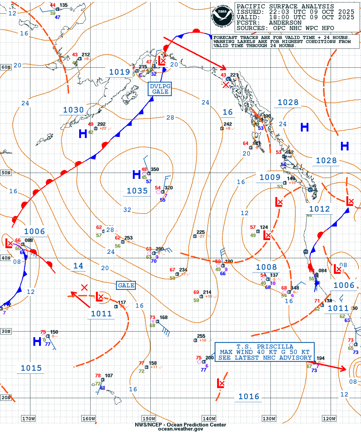
GEOS Local Image of Pacific Northwest
Edit Hide

Seattle/Tacoma, WA,

NOTICE: Some pages have affiliate links to Amazon. As an Amazon Associate, I earn from qualifying purchases. Please read website Cookie, Privacy, and Disclamers by clicking HERE. To contact me click HERE. For my YouTube page click HERE