Marine Weather and Tide Forecast for Port Gamble Tribal Comunity, WA
 | Sunrise 7:32 AM Sunset 6:17 PM Moonrise 1:48 PM Moonset 9:47 PM |
Marine Forecasts
NOTE: Zones updated 4/16/2026. Some zones changed. Use Edit if needed.
PZZ134 Admiralty Inlet- 433 Pm Pdt Sat Oct 17 2026
Tonight - NW wind 5 to 15 kt. Waves around 2 ft or less.
Sun - NW wind 5 to 10 kt. Waves around 2 ft or less.
Sun night - NW wind 5 to 10 kt. Waves around 2 ft or less.
Mon - W wind around 5 kt, veering to N around 5 kt in the afternoon. Waves around 2 ft or less.
Mon night - NW wind around 5 kt. Waves around 2 ft or less.
Tue - NW wind 5 to 10 kt, rising to 10 to 15 kt in the afternoon. Waves around 2 ft or less.
Tue night - NW wind 5 to 10 kt, easing to around 5 kt after midnight. Waves around 2 ft or less.
Wed - Light and variable winds, becoming nw around 5 kt in the afternoon. Waves around 2 ft or less.
Wed night - NW wind around 5 kt in the evening, becoming light and variable. Waves around 2 ft or less.
Thu - S wind around 5 kt, veering to W around 5 kt in the afternoon. Waves around 2 ft or less.
Thu night - W wind around 5 kt. Waves around 2 ft or less. A chance of rain.
PZZ100 433 Pm Pdt Sat Oct 17 2026
Synopsis for the northern and central washington coastal and inland waters - High pressure will build across the waters tonight into Sunday. A low pressure system passing southward well offshore will turn winds northerly or weakly offshore Sunday night into Monday. Weak high pressure will remain across the waters into the middle of the coming week for rather quiet conditions.
7 Day Forecast for Marine Location Near Port Gamble Tribal Comunity, WA

NEW! Add second zone forecast
| Port Gamble Click for Map Sat -- 03:29 AM PDT 0.42 feet Low Tide Sat -- 07:32 AM PDT Sunrise Sat -- 11:28 AM PDT 9.38 feet High Tide Sat -- 02:46 PM PDT Moonrise Sat -- 06:17 PM PDT Sunset Sat -- 06:22 PM PDT 7.29 feet Low Tide Sat -- 09:09 PM PDT 7.19 feet High Tide Sat -- 10:47 PM PDT Moonset Tide / Current data from XTide NOT FOR NAVIGATION |
Port Gamble, Washington, Tide feet
| 12 am |
| 4.3 |
| 1 am |
| 2.7 |
| 2 am |
| 1.3 |
| 3 am |
| 0.5 |
| 4 am |
| 0.5 |
| 5 am |
| 1.4 |
| 6 am |
| 2.9 |
| 7 am |
| 4.7 |
| 8 am |
| 6.5 |
| 9 am |
| 8 |
| 10 am |
| 8.9 |
| 11 am |
| 9.3 |
| 12 pm |
| 9.3 |
| 1 pm |
| 9.1 |
| 2 pm |
| 8.7 |
| 3 pm |
| 8.1 |
| 4 pm |
| 7.7 |
| 5 pm |
| 7.4 |
| 6 pm |
| 7.3 |
| 7 pm |
| 7.3 |
| 8 pm |
| 7.2 |
| 9 pm |
| 7.2 |
| 10 pm |
| 7.1 |
| 11 pm |
| 6.5 |
| Port Gamble Bay entrance (depth 10 ft) Click for Map Flood direction 197 true Ebb direction 14 true Sat -- 01:05 AM PDT -0.57 knots Max Ebb Sat -- 03:39 AM PDT 0.00 knots Slack Sat -- 07:08 AM PDT 1.20 knots Max Flood Sat -- 07:32 AM PDT Sunrise Sat -- 11:51 AM PDT -0.00 knots Slack Sat -- 02:10 PM PDT -0.22 knots Max Ebb Sat -- 02:46 PM PDT Moonrise Sat -- 05:58 PM PDT 0.00 knots Slack Sat -- 06:17 PM PDT Sunset Sat -- 07:33 PM PDT 0.07 knots Max Flood Sat -- 09:22 PM PDT -0.00 knots Slack Sat -- 10:47 PM PDT Moonset Tide / Current data from XTide NOT FOR NAVIGATION |
Port Gamble Bay entrance (depth 10 ft), Hood Canal, Washington Current, knots
| 12 am |
| -0.5 |
| 1 am |
| -0.6 |
| 2 am |
| -0.5 |
| 3 am |
| -0.2 |
| 4 am |
| 0.1 |
| 5 am |
| 0.6 |
| 6 am |
| 1 |
| 7 am |
| 1.2 |
| 8 am |
| 1.1 |
| 9 am |
| 0.8 |
| 10 am |
| 0.5 |
| 11 am |
| 0.2 |
| 12 pm |
| -0 |
| 1 pm |
| -0.2 |
| 2 pm |
| -0.2 |
| 3 pm |
| -0.2 |
| 4 pm |
| -0.2 |
| 5 pm |
| -0.1 |
| 6 pm |
| 0 |
| 7 pm |
| 0.1 |
| 8 pm |
| 0.1 |
| 9 pm |
| 0 |
| 10 pm |
| -0.1 |
| 11 pm |
| -0.2 |
FXUS66 KSEW 172056 AFDSEW
Area Forecast Discussion National Weather Service Seattle WA 156 PM PDT Sat Oct 17 2026
SYNOPSIS
Weak ridging builds into Western Washington early Sunday. An upper trough digs southwards along the coast late Sunday into Monday. Ridging builds back into the northern Pacific Northwest Tuesday and Wednesday. Troughing returns late week.
SHORT TERM /TONIGHT THROUGH MONDAY NIGHT/
A post-frontal airmass continues this afternoon with predominantly mostly sunny conditions. The exception being an area of weak convergence that continues over portions of central Puget Sound. Drier conditions will continue to develop into tonight as clouds taper off this evening. Mostly clear skies and lighter winds early Sunday AM will promote fog development, particularly in the usual areas and river valleys.
A weather system approaches the west coast late Sunday and Monday with the bulk of the energy digging southwards towards California early next week. Dry conditions continue on Monday due to the system being well offshore. Clouds will spread across Western Washington during this period. Otherwise, highs will be in the mid 50s to low 60s Sunday and Monday.
LONG TERM /TUESDAY THROUGH SATURDAY/
Upper ridging develops over British Columbia Tuesday and Wednesday with an upper low positioned well south of Western Washington, mainly offshore of central California. Dry conditions are expected Tuesday and Wednesday. AM fog will develop again both Tuesday and Wednesday morning with relatively light winds and clearer skies. In addition, areas of frost are expected each morning, mainly away from the water. Ensembles are consistent in the return of weak troughing Thursday into late week, bringing precipitation chances to the area, although rainfall amounts are not heavy due to the weakening nature of any frontal system. Temperatures look to remain near normal during this period, with highs peaking midweek. JD
AVIATION
West to northwest flow aloft will continue into Sunday morning before backing southwesterly in response to an upper trough diving southward over the offshore waters. Low level onshore flow will gradually weaken this afternoon into tonight then become northerly or weakly offshore on Sunday.
Ceilings within what is left of the convergence zone are mostly VFR this afternoon and will continue to lift and scatter out this afternoon and evening. Light surface winds and low level moisture will lead to the formation of IFR/LIFR fog and low clouds on Sunday morning...especially across the Southwest Interior and south portions of Puget Sound. Low clouds will lift for another VFR afternoon on Sunday under varying amounts of high level cloud cover.
KSEA...VFR ceilings remain this afternoon under the remnants of a convergence zone. Expect this to lift and scatter out late this afternoon and evening. Confidence remains fairly high that some LIFR fog and low clouds will be around the terminal on Sunday morning before scattering out by afternoon. Surface winds generally N/NE 5 to 8 knots.
27
MARINE
Surface high pressure will build across the waters tonight into Sunday in the wake of a frontal system that moved across the waters earlier today. A low pressure system passing southward well offshore will turn winds northerly or weakly offshore Sunday into Monday. Weak high pressure will remain across the waters into the middle of the coming week for rather quiet conditions. A larger swell train near 10 feet generated by active weather well offshore is expected to reach the coastal waters around Thursday.
27
SEW WATCHES/WARNINGS/ADVISORIES
WA...None.
PZ...Small Craft Advisory until 6 PM PDT this evening for Central U.S. Waters Strait Of Juan De Fuca-East Entrance U.S.
Waters Strait Of Juan De Fuca.
Small Craft Advisory until 8 PM PDT this evening for Coastal Waters From Cape Flattery To James Island 10 To 60 Nm- Coastal Waters From James Island To Point Grenville 10 To 60 Nm-Coastal Waters From Point Grenville To Cape Shoalwater 10 To 60 Nm.
Area Forecast Discussion National Weather Service Seattle WA 156 PM PDT Sat Oct 17 2026
SYNOPSIS
Weak ridging builds into Western Washington early Sunday. An upper trough digs southwards along the coast late Sunday into Monday. Ridging builds back into the northern Pacific Northwest Tuesday and Wednesday. Troughing returns late week.
SHORT TERM /TONIGHT THROUGH MONDAY NIGHT/
A post-frontal airmass continues this afternoon with predominantly mostly sunny conditions. The exception being an area of weak convergence that continues over portions of central Puget Sound. Drier conditions will continue to develop into tonight as clouds taper off this evening. Mostly clear skies and lighter winds early Sunday AM will promote fog development, particularly in the usual areas and river valleys.
A weather system approaches the west coast late Sunday and Monday with the bulk of the energy digging southwards towards California early next week. Dry conditions continue on Monday due to the system being well offshore. Clouds will spread across Western Washington during this period. Otherwise, highs will be in the mid 50s to low 60s Sunday and Monday.
LONG TERM /TUESDAY THROUGH SATURDAY/
Upper ridging develops over British Columbia Tuesday and Wednesday with an upper low positioned well south of Western Washington, mainly offshore of central California. Dry conditions are expected Tuesday and Wednesday. AM fog will develop again both Tuesday and Wednesday morning with relatively light winds and clearer skies. In addition, areas of frost are expected each morning, mainly away from the water. Ensembles are consistent in the return of weak troughing Thursday into late week, bringing precipitation chances to the area, although rainfall amounts are not heavy due to the weakening nature of any frontal system. Temperatures look to remain near normal during this period, with highs peaking midweek. JD
AVIATION
West to northwest flow aloft will continue into Sunday morning before backing southwesterly in response to an upper trough diving southward over the offshore waters. Low level onshore flow will gradually weaken this afternoon into tonight then become northerly or weakly offshore on Sunday.
Ceilings within what is left of the convergence zone are mostly VFR this afternoon and will continue to lift and scatter out this afternoon and evening. Light surface winds and low level moisture will lead to the formation of IFR/LIFR fog and low clouds on Sunday morning...especially across the Southwest Interior and south portions of Puget Sound. Low clouds will lift for another VFR afternoon on Sunday under varying amounts of high level cloud cover.
KSEA...VFR ceilings remain this afternoon under the remnants of a convergence zone. Expect this to lift and scatter out late this afternoon and evening. Confidence remains fairly high that some LIFR fog and low clouds will be around the terminal on Sunday morning before scattering out by afternoon. Surface winds generally N/NE 5 to 8 knots.
27
MARINE
Surface high pressure will build across the waters tonight into Sunday in the wake of a frontal system that moved across the waters earlier today. A low pressure system passing southward well offshore will turn winds northerly or weakly offshore Sunday into Monday. Weak high pressure will remain across the waters into the middle of the coming week for rather quiet conditions. A larger swell train near 10 feet generated by active weather well offshore is expected to reach the coastal waters around Thursday.
27
SEW WATCHES/WARNINGS/ADVISORIES
WA...None.
PZ...Small Craft Advisory until 6 PM PDT this evening for Central U.S. Waters Strait Of Juan De Fuca-East Entrance U.S.
Waters Strait Of Juan De Fuca.
Small Craft Advisory until 8 PM PDT this evening for Coastal Waters From Cape Flattery To James Island 10 To 60 Nm- Coastal Waters From James Island To Point Grenville 10 To 60 Nm-Coastal Waters From Point Grenville To Cape Shoalwater 10 To 60 Nm.
| Stations | Dist | Age | Wind | Air | Water | Waves | inHg | DewPt |
| WPOW1 - West Point, WA | 16 mi | 34 min | NNE 13G | 57°F | 30.23 | 47°F | ||
| PTWW1 - 9444900 - Port Townsend, WA | 20 mi | 56 min | WSW 8G | 53°F | 30.26 | |||
| BMTW1 | 21 mi | 56 min | SSW 4.1G | 30.25 | ||||
| EBSW1 - 9447130 - Seattle, WA | 22 mi | 56 min | 30.19 | |||||
| SISW1 - Smith Island, WA | 35 mi | 34 min | W 17G | 56°F | 30.22 | 46°F | ||
| TCMW1 - 9446482 - Tacoma Met, WA | 41 mi | 56 min | N 1G | |||||
| PBFW1 - Padilla Bay Reserve, WA | 42 mi | 44 min | W 4.1 | 58°F | 30.21 | 46°F | ||
| TCNW1 - 9446484 - Tacoma, WA | 42 mi | 56 min | 56°F | 30.23 | ||||
| 46088 - New Dungeness, WA (Hein Bank) | 46 mi | 34 min | W 19G | 55°F | 51°F | 30.22 | 46°F | |
| PTAW1 - 9444090 - Port Angeles, WA | 49 mi | 98 min | WNW 15G | 55°F | 51°F | 30.27 |
Wind History for Port Townsend, WA
toggle option: (graph/table)
Link to 5 hour of 5 minute data for KPAE
Terminal Aerodrome Forecast (TAF) for KPAE
Wind History Graph: PAE
(wind in knots)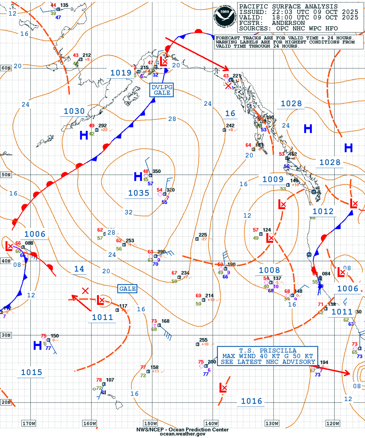
GEOS Local Image of Pacific Northwest
Edit Hide

Seattle/Tacoma, WA,

NOTICE: Some pages have affiliate links to Amazon. As an Amazon Associate, I earn from qualifying purchases. Please read website Cookie, Privacy, and Disclamers by clicking HERE. To contact me click HERE. For my YouTube page click HERE
X