Marine Weather and Tide Forecast for Clinton, WA
 | Sunrise 7:05 AM Sunset 4:40 PM Moonrise 6:45 AM Moonset 3:55 PM |
Marine Forecasts
NOTE: Zones updated 4/16/2026. Some zones changed. Use Edit if needed.
PZZ134 Admiralty Inlet- 1227 Am Pst Sun Nov 8 2026
.gale warning in effect until 4 am pst early this morning - .
Today - S wind 15 to 25 kt with gusts to 35 kt, easing to around 5 kt. Waves around 3 ft this morning, then around 2 ft or less. A chance of rain this morning, then a slight chance of rain early this afternoon.
Tonight - SE wind around 5 kt. Waves around 2 ft or less.
Mon - SE wind 10 to 15 kt, rising to 15 to 20 kt in the afternoon. Waves around 2 ft or less. Rain in the afternoon.
Mon night - SE wind 15 to 20 kt. Waves around 2 ft or less. Rain.
Tue - SE wind 20 to 25 kt. Gusts up to 35 kt in the afternoon. Waves around 3 ft. Rain.
Tue night - SE wind 20 to 25 kt with gusts up to 40 kt. Waves around 2 ft or less, then 3 to 4 ft after midnight. Rain, mainly in the evening.
Wed - SE wind 20 to 25 kt, easing to 15 to 20 kt in the afternoon. Waves around 3 ft.
Wed night - SE wind 10 to 15 kt, rising to 15 to 20 kt after midnight. Waves around 2 ft or less.
Thu - SE wind 15 to 20 kt, easing to 10 to 15 kt in the afternoon. Waves around 2 ft or less. A chance of rain in the afternoon.
Thu night - SE wind 10 to 15 kt, rising to 15 to 20 kt after midnight. Waves around 2 ft or less. Rain likely.
PZZ100 1227 Am Pst Sun Nov 8 2026
Synopsis for the northern and central washington coastal and inland waters - An active period of weather is expected across the area waters this weekend and into next week as a series of frontal systems cross the region. A surface low near 970 millibars will lift northeastward offshore tonight pushing a vigorous frontal system into the area. High pressure will briefly rebuild across the waters Sunday night into early Monday before another deepening surface low moving northward into the gulf of alaska pushes another front across the waters Monday night into Tuesday.
7 Day Forecast for Marine Location Near Clinton, WA

NEW! Add second zone forecast
| Glendale Click for Map Sun -- 04:54 AM PST 10.68 feet High Tide Sun -- 06:45 AM PST Moonrise Sun -- 07:05 AM PST Sunrise Sun -- 09:59 AM PST 5.92 feet Low Tide Sun -- 03:20 PM PST 10.57 feet High Tide Sun -- 03:55 PM PST Moonset Sun -- 04:40 PM PST Sunset Sun -- 10:17 PM PST -0.99 feet Low Tide Sun -- 11:02 PM PST New Moon Tide / Current data from XTide NOT FOR NAVIGATION |
Glendale, Whidbey Island, Washington, Tide feet
| 12 am |
| 2.3 |
| 1 am |
| 4.7 |
| 2 am |
| 7.1 |
| 3 am |
| 9.1 |
| 4 am |
| 10.3 |
| 5 am |
| 10.7 |
| 6 am |
| 10.2 |
| 7 am |
| 9 |
| 8 am |
| 7.5 |
| 9 am |
| 6.3 |
| 10 am |
| 5.9 |
| 11 am |
| 6.3 |
| 12 pm |
| 7.3 |
| 1 pm |
| 8.6 |
| 2 pm |
| 9.8 |
| 3 pm |
| 10.5 |
| 4 pm |
| 10.4 |
| 5 pm |
| 9.3 |
| 6 pm |
| 7.4 |
| 7 pm |
| 4.9 |
| 8 pm |
| 2.2 |
| 9 pm |
| 0.1 |
| 10 pm |
| -0.9 |
| 11 pm |
| -0.7 |
| Clinton Ferry Terminal (depth 21 ft) Click for Map Flood direction 4 true Ebb direction 178 true Sun -- 02:01 AM PST 0.28 knots Max Flood Sun -- 04:26 AM PST -0.00 knots Slack Sun -- 06:35 AM PST -0.22 knots Max Ebb Sun -- 06:45 AM PST Moonrise Sun -- 07:05 AM PST Sunrise Sun -- 11:20 AM PST 0.00 knots Slack Sun -- 01:28 PM PST 0.14 knots Max Flood Sun -- 03:08 PM PST -0.00 knots Slack Sun -- 03:55 PM PST Moonset Sun -- 04:40 PM PST Sunset Sun -- 06:29 PM PST -0.59 knots Max Ebb Sun -- 11:02 PM PST New Moon Sun -- 11:15 PM PST 0.00 knots Slack Tide / Current data from XTide NOT FOR NAVIGATION |
Clinton Ferry Terminal (depth 21 ft), Washington Current, knots
| 12 am |
| 0.2 |
| 1 am |
| 0.2 |
| 2 am |
| 0.3 |
| 3 am |
| 0.2 |
| 4 am |
| 0.1 |
| 5 am |
| -0.1 |
| 6 am |
| -0.2 |
| 7 am |
| -0.2 |
| 8 am |
| -0.2 |
| 9 am |
| -0.1 |
| 10 am |
| -0.1 |
| 11 am |
| -0 |
| 12 pm |
| 0.1 |
| 1 pm |
| 0.1 |
| 2 pm |
| 0.1 |
| 3 pm |
| 0 |
| 4 pm |
| -0.2 |
| 5 pm |
| -0.4 |
| 6 pm |
| -0.6 |
| 7 pm |
| -0.6 |
| 8 pm |
| -0.4 |
| 9 pm |
| -0.2 |
| 10 pm |
| -0.1 |
| 11 pm |
| -0 |
FXUS66 KSEW 081050 AFDSEW
Area Forecast Discussion National Weather Service Seattle WA 250 AM PST Sun Nov 8 2026
SYNOPSIS
Just a few post frontal showers today for Western Washington with the area in between systems. Next system arriving Monday night with a warm front right behind it Tuesday. Warm front lifting north Tuesday night. Trailing cold front stalling offshore Wednesday producing possible record high temperatures.
Cold front getting stretched out Wednesday night with an upper level trough digging south offshore. What is left of the front moving through Thursday night. An atmospheric river will set up over Western Washington Friday and Saturday.
SHORT TERM /TODAY THROUGH TUESDAY/
Quick hitting cold fronts like the one Saturday night almost always cause trouble. Front well to the east early this morning.
Satellite imagery and doppler radar showing post frontal shower activity over the area. Haven't seen any lightning strikes in the last hour. Temperatures at 2 am/10z are still mild, in the lower to mid 50s.
Calmer weather today across the area with post frontal shower activity drying up this afternoon. Still breezy in some locations this morning but winds aloft are easing quickly and onshore surface gradients are weakening. Under mostly cloudy/partly sunny skies temperatures will not warm up much from the current readings with highs in the mid 50s.
Even though the winds have eased post frontal high surf will keep dangerous conditions present along the beaches. The high surf warning will remain in effect today.
Temporary upper level ridge moving through the area tonight.
Low level flow going offshore with the approach of the next weather system. Some clearing overnight will allow temperatures to drop into the mid 30s in the colder locations. Most places a couple of degrees either side of 40. Seas subsiding overnight into the 15 to 18 foot range. Current forecast has the high surf warning expiring at 10 pm tonight.
Next frontal system approaching Western Washington Monday.
Parent low for the front well up into the Gulf of Alaska and moving north northwest. This will stretch out the front and cause it to become more north south oriented slowing down the eastward movement of the system. Rain reaching the coast early afternoon and over the interior by the Monday afternoon commute.
Highs again in the mid 50s.
Front slowly moving through Western Washington Monday evening with rain coming to an end after midnight. Windy conditions along the coast and over the Northwest Interior ( but nothing like we had Saturday ). Lows in the mid 40s to lower 50s.
Next system moving quickly across the Pacific has a long fetch of moisture with it, all the way back to 35N/150W. IVT values in the 800-1000 km/m/s range, some of the higher numbers we have seen so far this season. Rain moving back into the area during the day. Highs in the mid 50s. Felton
LONG TERM /TUESDAY NIGHT THROUGH SATURDAY/
Extended models showing good consistency lifting Tuesday's warm front to the north Tuesday night. Trailing cold front stalling off the coast Wednesday as a deep upper level trough digs south behind the cold front. This scenario puts Western Washington in the warm sector Wednesday with record highs, in the lower to mid 60s, possible.
Cold front stalled offshore Wednesday night getting stretched out and weakened as the trough continues to dig south. What is left of the front moving inland later Thursday into Thursday night.
Flow aloft consolidating offshore Friday with an atmospheric river setting up over Western Washington for more rain. Another upper level trough will dig south off the coast Friday night into Saturday. This trough will be a little further east than the one earlier in the week. This has the potential to pivot the atmospheric river right over Western Washington keeping rain going Friday night into Saturday.
Snow levels remaining elevated during the extended period with snow confined to the higher elevations well above pass levels.
Felton
AVIATION
The cold front has now traversed the area, leaving western Washington under mostly VFR conditions with scattered showers.
Terminals are reporting a scattered lower deck (2000-2500 ft), which may fill in to MVFR at times with the showers, but it should remain mostly scattered with a 15-25% chance of seeing MVFR conditions through this morning. Cloud coverage will slowly decrease throughout the day through high clouds will continue to stream overhead. Winds have peaked across the area but remain around 15-25 kt this morning with some gusts 20 to 35 kt. Winds start to ease below 10 kt after around 18-21Z this morning, then below 5 kt after 03Z Mon. Offshore flow will start to increase towards the very end of the TAF period around 12Z Mon.
KSEA...Mostly VFR conditions through the TAF period with a 20-30% chance of occasional MVFR cigs in heavier showers.
Showers and lower level clouds will start to decrease after 18-21Z this morning. South to southwest winds around 15 kt with gusts to 25 kt will slowly decrease today, with easing gusts and winds around 10 kt after 18Z this morning, becoming around 5 kt or less this evening. Winds become more easterly after 06Z Mon.
62
MARINE
Winds have peaked over the coastal waters early this morning and will continue to ease through the morning hours. Gale force winds over all the area waters will ease below thresholds this morning for a brief period of calmer winds through late tonight before the next frontal system begins to move across the coastal waters on Monday.
Winds will begin to increase again early Monday morning, peaking in the afternoon the frontal system traverses the area. Additional headlines will be likely for all area waters, though Gale Watches have been issued for the coastal waters and East Strait of Juan de Fuca where confidence is highest in gale force gusts (50-80% chc).
Winds will decrease again Monday evening but not for long as another system will be on its heels for another round of stronger winds overnight Monday and throughout the day Tuesday. Additional frontal systems will move through the waters mid to late week, likely bringing more rounds of widespread headlines to the area waters.
Seas remain on their way up early this morning but are expected to top out in the 20-25 ft range this afternoon. Seas will ease tonight into Monday to around 12-15 ft before the next system brings seas back to the 16-18 ft range on Tuesday. Seas will lower and rise through mid to late week but remain above 13 ft through the end of the week, with the next best chance for seas above 20 ft over this weekend.
62
HYDROLOGY
River flooding is not expected the next seven days. Multiple weather systems moving through the area in the next week. While current precipitation forecasts are not expected to cause flooding, this will saturate soils and raise base flows. If the atmospheric river stalls over the area late next week into next weekend we might need to keep an eye on our old friend the Skokomish River. Felton
SEW WATCHES/WARNINGS/ADVISORIES
WA...High Surf Warning until 10 PM PST this evening for Grays Harbor County Coast-Northern Washington Coast.
PZ...Small Craft Advisory until 4 AM PST Monday for Grays Harbor Bar.
Gale Warning until 10 AM PST this morning for Central U.S.
Waters Strait Of Juan De Fuca-East Entrance U.S. Waters Strait Of Juan De Fuca-West Entrance U.S. Waters Strait Of Juan De Fuca.
Gale Watch from Monday morning through Monday evening for East Entrance U.S. Waters Strait Of Juan De Fuca.
Gale Warning until 4 AM PST early this morning for Admiralty Inlet-Northern Inland Waters Including The San Juan Islands.
Gale Warning until 7 AM PST this morning for Coastal Waters From Cape Flattery To James Island 10 To 60 Nm-Coastal Waters From Cape Flattery To James Island Out 10 Nm- Coastal Waters From James Island To Point Grenville 10 To 60 Nm-Coastal Waters From James Island To Point Grenville Out 10 Nm-Coastal Waters From Point Grenville To Cape Shoalwater 10 To 60 Nm-Coastal Waters From Point Grenville To Cape Shoalwater Out 10 Nm-Puget Sound and Hood Canal.
Small Craft Advisory from 7 AM this morning to 4 AM PST Monday for Coastal Waters From Cape Flattery To James Island 10 To 60 Nm-Coastal Waters From Cape Flattery To James Island Out 10 Nm-Coastal Waters From James Island To Point Grenville 10 To 60 Nm-Coastal Waters From James Island To Point Grenville Out 10 Nm-Coastal Waters From Point Grenville To Cape Shoalwater 10 To 60 Nm-Coastal Waters From Point Grenville To Cape Shoalwater Out 10 Nm.
Gale Watch from late tonight through Monday evening for Coastal Waters From Cape Flattery To James Island 10 To 60 Nm-Coastal Waters From Cape Flattery To James Island Out 10 Nm-Coastal Waters From James Island To Point Grenville 10 To 60 Nm-Coastal Waters From James Island To Point Grenville Out 10 Nm-Coastal Waters From Point Grenville To Cape Shoalwater 10 To 60 Nm-Coastal Waters From Point Grenville To Cape Shoalwater Out 10 Nm.
Area Forecast Discussion National Weather Service Seattle WA 250 AM PST Sun Nov 8 2026
SYNOPSIS
Just a few post frontal showers today for Western Washington with the area in between systems. Next system arriving Monday night with a warm front right behind it Tuesday. Warm front lifting north Tuesday night. Trailing cold front stalling offshore Wednesday producing possible record high temperatures.
Cold front getting stretched out Wednesday night with an upper level trough digging south offshore. What is left of the front moving through Thursday night. An atmospheric river will set up over Western Washington Friday and Saturday.
SHORT TERM /TODAY THROUGH TUESDAY/
Quick hitting cold fronts like the one Saturday night almost always cause trouble. Front well to the east early this morning.
Satellite imagery and doppler radar showing post frontal shower activity over the area. Haven't seen any lightning strikes in the last hour. Temperatures at 2 am/10z are still mild, in the lower to mid 50s.
Calmer weather today across the area with post frontal shower activity drying up this afternoon. Still breezy in some locations this morning but winds aloft are easing quickly and onshore surface gradients are weakening. Under mostly cloudy/partly sunny skies temperatures will not warm up much from the current readings with highs in the mid 50s.
Even though the winds have eased post frontal high surf will keep dangerous conditions present along the beaches. The high surf warning will remain in effect today.
Temporary upper level ridge moving through the area tonight.
Low level flow going offshore with the approach of the next weather system. Some clearing overnight will allow temperatures to drop into the mid 30s in the colder locations. Most places a couple of degrees either side of 40. Seas subsiding overnight into the 15 to 18 foot range. Current forecast has the high surf warning expiring at 10 pm tonight.
Next frontal system approaching Western Washington Monday.
Parent low for the front well up into the Gulf of Alaska and moving north northwest. This will stretch out the front and cause it to become more north south oriented slowing down the eastward movement of the system. Rain reaching the coast early afternoon and over the interior by the Monday afternoon commute.
Highs again in the mid 50s.
Front slowly moving through Western Washington Monday evening with rain coming to an end after midnight. Windy conditions along the coast and over the Northwest Interior ( but nothing like we had Saturday ). Lows in the mid 40s to lower 50s.
Next system moving quickly across the Pacific has a long fetch of moisture with it, all the way back to 35N/150W. IVT values in the 800-1000 km/m/s range, some of the higher numbers we have seen so far this season. Rain moving back into the area during the day. Highs in the mid 50s. Felton
LONG TERM /TUESDAY NIGHT THROUGH SATURDAY/
Extended models showing good consistency lifting Tuesday's warm front to the north Tuesday night. Trailing cold front stalling off the coast Wednesday as a deep upper level trough digs south behind the cold front. This scenario puts Western Washington in the warm sector Wednesday with record highs, in the lower to mid 60s, possible.
Cold front stalled offshore Wednesday night getting stretched out and weakened as the trough continues to dig south. What is left of the front moving inland later Thursday into Thursday night.
Flow aloft consolidating offshore Friday with an atmospheric river setting up over Western Washington for more rain. Another upper level trough will dig south off the coast Friday night into Saturday. This trough will be a little further east than the one earlier in the week. This has the potential to pivot the atmospheric river right over Western Washington keeping rain going Friday night into Saturday.
Snow levels remaining elevated during the extended period with snow confined to the higher elevations well above pass levels.
Felton
AVIATION
The cold front has now traversed the area, leaving western Washington under mostly VFR conditions with scattered showers.
Terminals are reporting a scattered lower deck (2000-2500 ft), which may fill in to MVFR at times with the showers, but it should remain mostly scattered with a 15-25% chance of seeing MVFR conditions through this morning. Cloud coverage will slowly decrease throughout the day through high clouds will continue to stream overhead. Winds have peaked across the area but remain around 15-25 kt this morning with some gusts 20 to 35 kt. Winds start to ease below 10 kt after around 18-21Z this morning, then below 5 kt after 03Z Mon. Offshore flow will start to increase towards the very end of the TAF period around 12Z Mon.
KSEA...Mostly VFR conditions through the TAF period with a 20-30% chance of occasional MVFR cigs in heavier showers.
Showers and lower level clouds will start to decrease after 18-21Z this morning. South to southwest winds around 15 kt with gusts to 25 kt will slowly decrease today, with easing gusts and winds around 10 kt after 18Z this morning, becoming around 5 kt or less this evening. Winds become more easterly after 06Z Mon.
62
MARINE
Winds have peaked over the coastal waters early this morning and will continue to ease through the morning hours. Gale force winds over all the area waters will ease below thresholds this morning for a brief period of calmer winds through late tonight before the next frontal system begins to move across the coastal waters on Monday.
Winds will begin to increase again early Monday morning, peaking in the afternoon the frontal system traverses the area. Additional headlines will be likely for all area waters, though Gale Watches have been issued for the coastal waters and East Strait of Juan de Fuca where confidence is highest in gale force gusts (50-80% chc).
Winds will decrease again Monday evening but not for long as another system will be on its heels for another round of stronger winds overnight Monday and throughout the day Tuesday. Additional frontal systems will move through the waters mid to late week, likely bringing more rounds of widespread headlines to the area waters.
Seas remain on their way up early this morning but are expected to top out in the 20-25 ft range this afternoon. Seas will ease tonight into Monday to around 12-15 ft before the next system brings seas back to the 16-18 ft range on Tuesday. Seas will lower and rise through mid to late week but remain above 13 ft through the end of the week, with the next best chance for seas above 20 ft over this weekend.
62
HYDROLOGY
River flooding is not expected the next seven days. Multiple weather systems moving through the area in the next week. While current precipitation forecasts are not expected to cause flooding, this will saturate soils and raise base flows. If the atmospheric river stalls over the area late next week into next weekend we might need to keep an eye on our old friend the Skokomish River. Felton
SEW WATCHES/WARNINGS/ADVISORIES
WA...High Surf Warning until 10 PM PST this evening for Grays Harbor County Coast-Northern Washington Coast.
PZ...Small Craft Advisory until 4 AM PST Monday for Grays Harbor Bar.
Gale Warning until 10 AM PST this morning for Central U.S.
Waters Strait Of Juan De Fuca-East Entrance U.S. Waters Strait Of Juan De Fuca-West Entrance U.S. Waters Strait Of Juan De Fuca.
Gale Watch from Monday morning through Monday evening for East Entrance U.S. Waters Strait Of Juan De Fuca.
Gale Warning until 4 AM PST early this morning for Admiralty Inlet-Northern Inland Waters Including The San Juan Islands.
Gale Warning until 7 AM PST this morning for Coastal Waters From Cape Flattery To James Island 10 To 60 Nm-Coastal Waters From Cape Flattery To James Island Out 10 Nm- Coastal Waters From James Island To Point Grenville 10 To 60 Nm-Coastal Waters From James Island To Point Grenville Out 10 Nm-Coastal Waters From Point Grenville To Cape Shoalwater 10 To 60 Nm-Coastal Waters From Point Grenville To Cape Shoalwater Out 10 Nm-Puget Sound and Hood Canal.
Small Craft Advisory from 7 AM this morning to 4 AM PST Monday for Coastal Waters From Cape Flattery To James Island 10 To 60 Nm-Coastal Waters From Cape Flattery To James Island Out 10 Nm-Coastal Waters From James Island To Point Grenville 10 To 60 Nm-Coastal Waters From James Island To Point Grenville Out 10 Nm-Coastal Waters From Point Grenville To Cape Shoalwater 10 To 60 Nm-Coastal Waters From Point Grenville To Cape Shoalwater Out 10 Nm.
Gale Watch from late tonight through Monday evening for Coastal Waters From Cape Flattery To James Island 10 To 60 Nm-Coastal Waters From Cape Flattery To James Island Out 10 Nm-Coastal Waters From James Island To Point Grenville 10 To 60 Nm-Coastal Waters From James Island To Point Grenville Out 10 Nm-Coastal Waters From Point Grenville To Cape Shoalwater 10 To 60 Nm-Coastal Waters From Point Grenville To Cape Shoalwater Out 10 Nm.
| Stations | Dist | Age | Wind | Air | Water | Waves | inHg | DewPt |
| WPOW1 - West Point, WA | 20 mi | 26 min | S 27G | 56°F | 29.85 | 49°F | ||
| EBSW1 - 9447130 - Seattle, WA | 23 mi | 46 min | 29.83 | |||||
| PTWW1 - 9444900 - Port Townsend, WA | 24 mi | 46 min | ESE 19G | 55°F | 55°F | 29.78 | ||
| BMTW1 | 30 mi | 46 min | ENE 9.9G | 54°F | 29.87 | |||
| SISW1 - Smith Island, WA | 36 mi | 26 min | SSE 26G | 54°F | 29.76 | 50°F | ||
| PBFW1 - Padilla Bay Reserve, WA | 37 mi | 46 min | SSE 14 | 54°F | 29.77 | 50°F | ||
| TCMW1 - 9446482 - Tacoma Met, WA | 46 mi | 46 min | SE 11G | 55°F | ||||
| TCNW1 - 9446484 - Tacoma, WA | 47 mi | 46 min | 55°F | 29.92 |
Wind History for Port Townsend, WA
toggle option: (graph/table)
| Airport | Dist | Age | Wind kt | Vis | Sky | Weather | Air | DewPt | RH | inHg |
| KPAE Seattle Paine Field International Airport US | 5 sm | 22 min | S 17G28 | 10 sm | Overcast | Lt Rain | 52°F | 46°F | 82% | 29.87 |
| KAWO Arlington Municipal Airport US | 19 sm | 19 min | SSE 19G29 | 10 sm | Overcast | Lt Rain | 54°F | 48°F | 82% | 29.85 |
| KNRA Coupeville Nolf Airport US | 22 sm | 29 min | SSE 10G23 | 10 sm | Overcast | Lt Rain | 54°F | 48°F | 82% | 29.78 |
Link to 5 hour of 5 minute data for KPAE
Terminal Aerodrome Forecast (TAF) for KPAE
Wind History Graph: PAE
(wind in knots)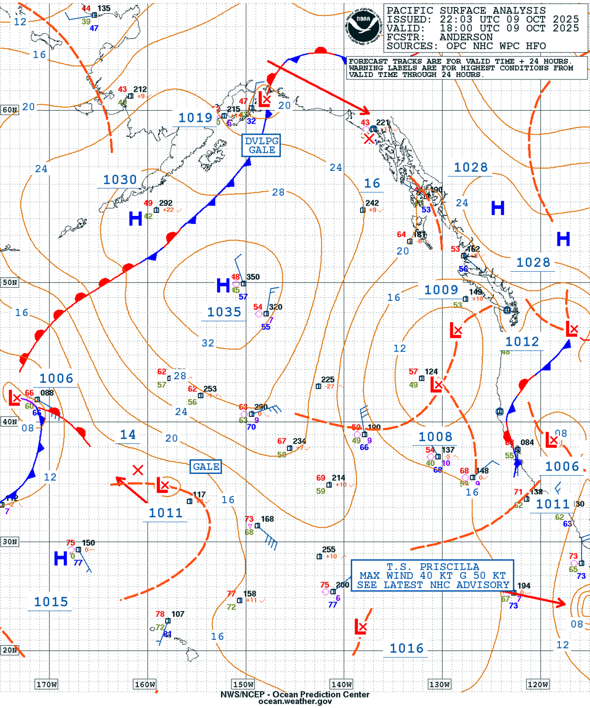
GEOS Local Image of Pacific Northwest
Edit Hide

Seattle/Tacoma, WA,

NOTICE: Some pages have affiliate links to Amazon. As an Amazon Associate, I earn from qualifying purchases. Please read website Cookie, Privacy, and Disclamers by clicking HERE. To contact me click HERE. For my YouTube page click HERE
X